Typhoon Kong-rey is expected to make landfall on Taiwan’s east coast today, with work and classes canceled nationwide.
Packing gusts of nearly 300kph, the storm yesterday intensified into a typhoon and was expected to gain even more strength before hitting Taitung County, the US Navy’s Joint Typhoon Warning Center said.
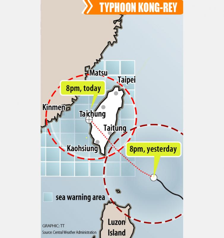
The storm is forecast to cross Taiwan’s south, enter the Taiwan Strait and head toward China, the Central Weather Administration (CWA) said.

The CWA labeled the storm a “strong typhoon,” the most powerful on its scale.
Up to 1.2m of rainfall was expected in mountainous areas of eastern Taiwan and destructive winds are likely to hit coastal areas today, the CWA said.
President William Lai (賴清德) urged people to stay away from the mountains and coast.

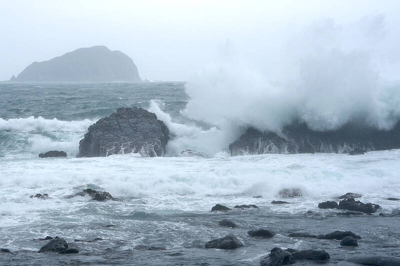
Photo: AP
“I would like to urge my friends in the eastern, southern and northern parts of the country to be on alert,” Lai wrote on Facebook.
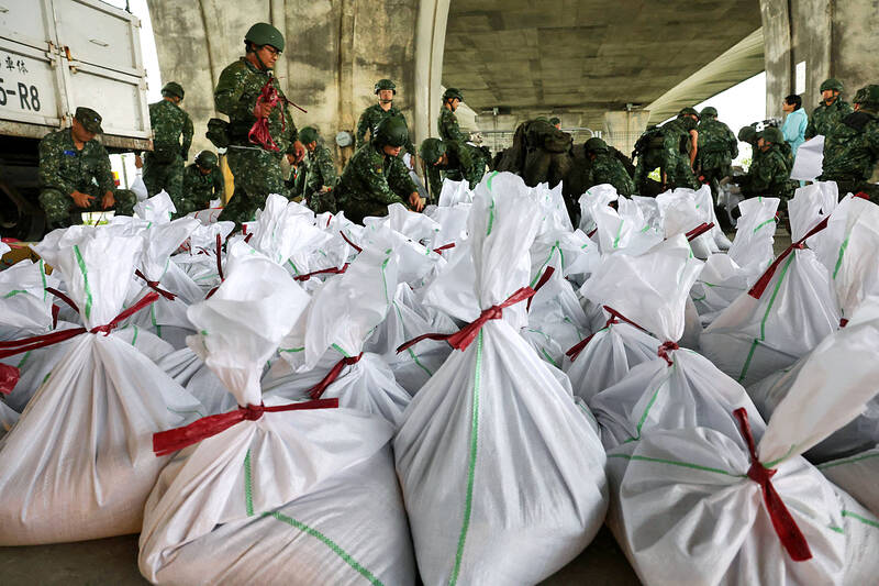
The Ministry of National Defense said it had put about 36,000 troops on standby across the nation.
A CWA forecaster said it was relatively rare for a strong typhoon to directly hit Taiwan this late in the year, pointing to the favorable environment for typhoons, including warmer sea temperatures in the Pacific and later-than-normal cold fronts from the north.

Photo: AFP
“We must urge people to make preparations. It’s a strong typhoon with a large size,” he added.
Heavy rain is also expected in the north around Taipei throughout the day today, the CWA said.
Extremely heavy rain or torrential rain advisories were in effect from yesterday evening through early tomorrow for mountainous areas of Yilan and Hualien counties, with other rain advisories for the Keelung north coast, Taipei, New Taipei City, Taitung County, Taoyuan, Hsinchu County, Taichung, the Hengchun Peninsula, Orchid (Lanyu, 蘭嶼) and Green (綠島) islands.
The Ministry of Transportation and Communications said at least 26 ferry trips to outlying counties had been stopped yesterday, while UNI Air (立榮航空) and Mandarin Airlines (華信航空) separately said that they had canceled all domestic flights for today.
China Airlines (中華航空), Tigerair Taiwan (台灣虎航), Singapore Airlines and Starlux Airlines (星宇航空) issued notices of delays, rescheduling or cancelations of international flights to and from Taiwan.
People planning to fly to, from, or within Taiwan today are advised to check their flight status on their carrier’s Web site.
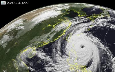
Typhoon Kong-rey is the largest storm to hit Taiwan in 27 years, the CWA said.
Kong-rey’s radius of maximum wind (RMW) — the distance between the center of a typhoon and its band of strongest winds — had expanded to 320km, CWA forecaster Chang Chun-yao (張竣堯) said.
The last time that a typhoon of comparable strength with an RMW larger than 300km made landfall in Taiwan was Typhoon Herb in 1996, Chang said.
A weather station on Alishan (阿里山) recorded 1.09m of rainfall in a single day during that storm on July 31, 1996, he added.

Super Typhoon Kong-rey is the largest cyclone to impact Taiwan in 27 years, the Central Weather Administration (CWA) said today. Kong-rey’s radius of maximum wind (RMW) — the distance between the center of a cyclone and its band of strongest winds — has expanded to 320km, CWA forecaster Chang Chun-yao (張竣堯) said. The last time a typhoon of comparable strength with an RMW larger than 300km made landfall in Taiwan was Typhoon Herb in 1996, he said. Herb made landfall between Keelung and Suao (蘇澳) in Yilan County with an RMW of 350km, Chang said. The weather station in Alishan (阿里山) recorded 1.09m of

STORM’S PATH: Kong-Rey could be the first typhoon to make landfall in Taiwan in November since Gilda in 1967. Taitung-Green Island ferry services have been halted Tropical Storm Kong-rey is forecast to strengthen into a typhoon early today and could make landfall in Taitung County between late Thursday and early Friday, the Central Weather Administration (CWA) said yesterday. As of 2pm yesterday, Kong-Rey was 1,030km east-southeast of Oluanpi (鵝鑾鼻), the nation’s southernmost point, and was moving west at 7kph. The tropical storm was packing maximum sustained winds of 101kph, with gusts of up to 126 kph, CWA data showed. After landing in Taitung, the eye of the storm is forecast to move into the Taiwan Strait through central Taiwan on Friday morning, the agency said. With the storm moving

NO WORK, CLASS: President William Lai urged people in the eastern, southern and northern parts of the country to be on alert, with Typhoon Kong-rey approaching Typhoon Kong-rey is expected to make landfall on Taiwan’s east coast today, with work and classes canceled nationwide. Packing gusts of nearly 300kph, the storm yesterday intensified into a typhoon and was expected to gain even more strength before hitting Taitung County, the US Navy’s Joint Typhoon Warning Center said. The storm is forecast to cross Taiwan’s south, enter the Taiwan Strait and head toward China, the Central Weather Administration (CWA) said. The CWA labeled the storm a “strong typhoon,” the most powerful on its scale. Up to 1.2m of rainfall was expected in mountainous areas of eastern Taiwan and destructive winds are likely

The Central Weather Administration (CWA) yesterday at 5:30pm issued a sea warning for Typhoon Kong-rey as the storm drew closer to the east coast. As of 8pm yesterday, the storm was 670km southeast of Oluanpi (鵝鑾鼻) and traveling northwest at 12kph to 16kph. It was packing maximum sustained winds of 162kph and gusts of up to 198kph, the CWA said. A land warning might be issued this morning for the storm, which is expected to have the strongest impact on Taiwan from tonight to early Friday morning, the agency said. Orchid Island (Lanyu, 蘭嶼) and Green Island (綠島) canceled classes and work