The US Marine Corps and the Japan Ground Self-Defense Force have begun a military drill to simulate the retaking of outlying islands in Kyushu and Okinawa Prefecture in a conflict scenario, the Sankei Shimbun reported yesterday.
The drill, commonly known as “Iron Fist,” has been held in the US since 2006 before being moved to Japan for the first time this year, it said.
The large-scale operations are conducted with a possible “Taiwan emergency” in mind, aiming to keep China in check, it said.
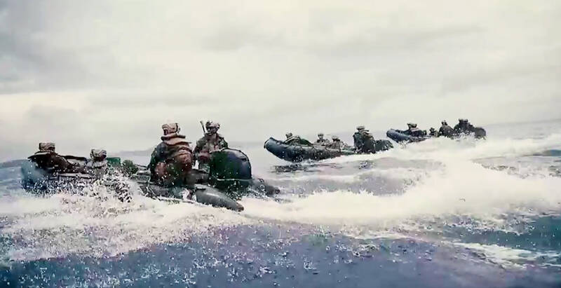
Photo: Screen grab from video on US Marine Corps’ Web site
Unlike last year’s exercises, which focused on on-site training, this year’s maneuvers include strategy formulation and command for each unit by the Japanese and US headquarters, to bolster cooperation between higher-level departments, it said.
Scheduled to run until March 17, the militaries are to conduct landing drills on Okinoerabujima in Kagoshima Prefecture and the town of Kin in Okinawa, as well as F-35 stealth jet target practice on an uninhabited island west of Okinawa’s main island.
A Japanese Army settlement in Kumamoto Prefecture would be used as a maintenance base for helicopters, the report said.
About 600 members of the Japan Ground Self-Defense Force’s Amphibious Rapid Deployment Brigade are to land on and recapture occupied islands participating in the drill, it said.
The Japan Self-Defense Forces and the US military earlier this month conducted the highest-level military exercise, Keen Edge, in which a possible Taiwan contingency was set as the main scenario and China as a hypothetical enemy.
In other developments, the Chungshan Institute of Science and Technology is to conduct this year’s first tests of artillery and uncrewed aerial surveillance and reconnaissance vehicles at Jioupeng Military Base in Pingtung County’s Manjhou Township (滿州) next month, the Ministry of Transportation and Communications’ Maritime Port Bureau said.
The institute is to conduct the tests on five days — from Wednesday next week to Friday next week as well as March 13 and March 14 — during which the following areas would be under control: between Taitung County’s Taimali Township (太麻里) and Pingtung’s Majhou, as well as between the northwest of Orchid Island (Lanyu, 蘭嶼) and the south of Green Island, the bureau said in an announcement on Monday last week.
On Thursday and Friday next week, tests are to take place from 6am to 5pm and the sea areas are to be closed from midnight to early morning on both days, it said.
For the artillery tests, the bureau marked a danger zone of a minimum radius of 5 nautical miles (9.3km) and said that the maximum projectile altitude would be 7.62km.
For the uncrewed surveillance and reconnaissance aerial vehicles, the marked danger zone has a minimum radius of 12 nautical miles, possibly for conducting high-altitude reconnaissance operations.
The institute previously conducted missile tests in August and November last year.
While it was reported that Hsiung Feng II-E (雄風, “Brave Wind”) missiles were fired in August last year, the military has provided no further information regarding the tests, as well as next month’s tests.
Possible candidates include surface-to-air Tien Kung (天弓, “Sky Bow”) missiles, Wan Chien (萬劍, “Thousand Sword”) cluster-munition missiles and Yu Cha (魚叉, “Harpoon”) anti-ship missiles.

AIR SUPPORT: The Ministry of National Defense thanked the US for the delivery, adding that it was an indicator of the White House’s commitment to the Taiwan Relations Act Deputy Minister of National Defense Po Horng-huei (柏鴻輝) and Representative to the US Alexander Yui on Friday attended a delivery ceremony for the first of Taiwan’s long-awaited 66 F-16C/D Block 70 jets at a Lockheed Martin Corp factory in Greenville, South Carolina. “We are so proud to be the global home of the F-16 and to support Taiwan’s air defense capabilities,” US Representative William Timmons wrote on X, alongside a photograph of Taiwanese and US officials at the event. The F-16C/D Block 70 jets Taiwan ordered have the same capabilities as aircraft that had been upgraded to F-16Vs. The batch of Lockheed Martin

GRIDLOCK: The National Fire Agency’s Special Search and Rescue team is on standby to travel to the countries to help out with the rescue effort A powerful earthquake rocked Myanmar and neighboring Thailand yesterday, killing at least three people in Bangkok and burying dozens when a high-rise building under construction collapsed. Footage shared on social media from Myanmar’s second-largest city showed widespread destruction, raising fears that many were trapped under the rubble or killed. The magnitude 7.7 earthquake, with an epicenter near Mandalay in Myanmar, struck at midday and was followed by a strong magnitude 6.4 aftershock. The extent of death, injury and destruction — especially in Myanmar, which is embroiled in a civil war and where information is tightly controlled at the best of times —
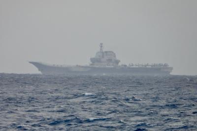
China's military today said it began joint army, navy and rocket force exercises around Taiwan to "serve as a stern warning and powerful deterrent against Taiwanese independence," calling President William Lai (賴清德) a "parasite." The exercises come after Lai called Beijing a "foreign hostile force" last month. More than 10 Chinese military ships approached close to Taiwan's 24 nautical mile (44.4km) contiguous zone this morning and Taiwan sent its own warships to respond, two senior Taiwanese officials said. Taiwan has not yet detected any live fire by the Chinese military so far, one of the officials said. The drills took place after US Secretary

THUGGISH BEHAVIOR: Encouraging people to report independence supporters is another intimidation tactic that threatens cross-strait peace, the state department said China setting up an online system for reporting “Taiwanese independence” advocates is an “irresponsible and reprehensible” act, a US government spokesperson said on Friday. “China’s call for private individuals to report on alleged ‘persecution or suppression’ by supposed ‘Taiwan independence henchmen and accomplices’ is irresponsible and reprehensible,” an unnamed US Department of State spokesperson told the Central News Agency in an e-mail. The move is part of Beijing’s “intimidation campaign” against Taiwan and its supporters, and is “threatening free speech around the world, destabilizing the Indo-Pacific region, and deliberately eroding the cross-strait status quo,” the spokesperson said. The Chinese Communist Party’s “threats