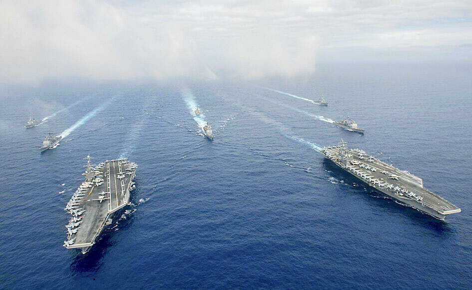
The US and its allies could break a Chinese blockade of Taiwan, US Pacific Fleet Commander Admiral Samuel Paparo said.
The Chinese People’s Liberation Army Navy has “the number of vessels and the capability at sea to execute a blockade,” he told a news conference marking US Secretary of Defense Lloyd Austin’s visit to Hawaii on Saturday, Nikkei Asia reported.
“The question that follows is: ‘Do the allies have the capability to break that blockade?’ And the answer to that is a resounding yes,” he said.

Photo: Reuters
The US military alone could defeat a Chinese blockade with its volume of firepower and “superiority in key domains,” he said, likely referring to nuclear submarines and other undersea forces.
However, an unnamed US official told Nikkei that Beijing could use means other than naval forces to effectively blockade Taiwan.
Citing Beijing’s military exercises in August, the official said China fired 11 ballistic missiles into designated exercise areas in the waters off the ports of Taipei and Kaohsiung, causing disruptions to maritime and air traffic.
“That’s a pretty significant impact on normal activities,” the official said, underscoring the missile threat to Taiwan’s aerial and marine lines of communication.
“You could essentially blockade Taiwan’s access, through the repeated imposition of these kinds of closure areas, legally, safely and in a way that would be extraordinarily difficult, either for Taiwan or the US, to challenge and to counter,” they said.
A senior Taiwanese official was cited by Nikkei as saying that the nation would not bow to Beijing’s pressure.
“The Chinese pressure campaign, coercion campaign, has proven to be counterproductive,” said the official, who spoke on condition of anonymity.
“These coercive measures not only strengthen our people’s determination, our will, to defend our own democracy, but also rally international support to Taiwan,” they said.

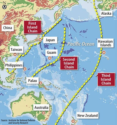
The US government has signed defense cooperation agreements with Japan and the Philippines to boost the deterrence capabilities of countries in the first island chain, a report by the National Security Bureau (NSB) showed. The main countries on the first island chain include the two nations and Taiwan. The bureau is to present the report at a meeting of the legislature’s Foreign Affairs and National Defense Committee tomorrow. The US military has deployed Typhon missile systems to Japan’s Yamaguchi Prefecture and Zambales province in the Philippines during their joint military exercises. It has also installed NMESIS anti-ship systems in Japan’s Okinawa

‘WIN-WIN’: The Philippines, and central and eastern European countries are important potential drone cooperation partners, Minister of Foreign Affairs Lin Chia-lung said Minister of Foreign Affairs Lin Chia-lung (林佳龍) in an interview published yesterday confirmed that there are joint ventures between Taiwan and Poland in the drone industry. Lin made the remark in an exclusive interview with the Chinese-language Liberty Times (the Taipei Times’ sister paper). The government-backed Taiwan Excellence Drone International Business Opportunities Alliance and the Polish Chamber of Unmanned Systems on Wednesday last week signed a memorandum of understanding in Poland to develop a “non-China” supply chain for drones and work together on key technologies. Asked if Taiwan prioritized Poland among central and eastern European countries in drone collaboration, Lin

NO CONFIDENCE MOTION? The premier said that being toppled by the legislature for defending the Constitution would be a democratic badge of honor for him Premier Cho Jung-tai (卓榮泰) yesterday announced that the Cabinet would not countersign the amendments to the local revenue-sharing law passed by the Legislative Yuan last month. Cho said the decision not to countersign the amendments to the Act Governing the Allocation of Government Revenues and Expenditures (財政收支劃分法) was made in accordance with the Constitution. “The decision aims to safeguard our Constitution,” he said. The Constitution stipulates the president shall, in accordance with law, promulgate laws and issue mandates with the countersignature of the head of the Executive Yuan, or with the countersignatures of both the head of the Executive Yuan and ministers or

BACK TO WORK? Prosecutors said they are considering filing an appeal, while the Hsinchu City Government said it has applied for Ann Kao’s reinstatement as mayor The High Court yesterday found suspended Hsinchu mayor Ann Kao (高虹安) not guilty of embezzling assistant fees, reducing her sentence to six months in prison commutable to a fine from seven years and four months. The verdict acquitted Kao of the corruption charge, but found her guilty of causing a public official to commit document forgery. The High Prosecutors’ Office said it is reviewing the ruling and considering whether to file an appeal. The Taipei District Court in July last year sentenced Kao to seven years and four months in prison, along with a four-year deprivation of civil rights, for contravening the Anti-Corruption