Two US military aircraft reportedly flew close to the nation’s southern airspace yesterday, one day after the Ministry of National Defense confirmed that a Chinese People’s Liberation Army Navy (PLAN) aircraft carrier battle group sailed east of the country.
A US RC-135W Rivet Joint and a Lockheed P-3 Orion were operating in the South China Sea, according to flight charts posted on Twitter yesterday morning by Aircraft Spots, a military air movement tracker.
Based on the Twitter posts, the two planes flew at different intervals, with the RC-135W reconnaissance plane spotted first over the Bashi Channel, southwest of Taiwan.
Ministry spokesman Major General Shih Shun-wen (史順文) did not directly confirm the aircraft sightings, except to say the military is closely monitoring the nation’s surrounding waters and airspace.
According to charts released by Aircraft Spots and the ministry’s own records, the latest incident was the 10th time US aircraft have operated near the nation’s airspace since March 25.
The ministry on Sunday evening said that a PLAN aircraft carrier, the Liaoning, escorted by two destroyers, two frigates and a supply ship, were monitored as they passed through the Miyako Strait to the northeast of Taiwan on Saturday, headed south.
The flotilla passed to the east of Taiwan on Sunday as it moved southward on a long-range training mission, the ministry said, adding that no unusual activities were detected.
Su Tzu-yun (蘇紫雲), a senior analyst at the Taipei-based Institute of National Defense and Security Research, on Sunday said that Beijing has expanded its maritime and air presence in the Indo-Pacific region.
“This is probably the main reason US reconnaissance planes have recently been spotted operating near the Bashi Channel, to monitor the movements of the People’s Liberation Army in the area,” Su said.
Presidential Office spokesman Ting Yun-kung (丁允恭) on Sunday said the public has no need to worry about the nation’s safety and security.

‘DANGEROUS GAME’: Legislative Yuan budget cuts have already become a point of discussion for Democrats and Republicans in Washington, Elbridge Colby said Taiwan’s fall to China “would be a disaster for American interests” and Taipei must raise defense spending to deter Beijing, US President Donald Trump’s pick to lead Pentagon policy, Elbridge Colby, said on Tuesday during his US Senate confirmation hearing. The nominee for US undersecretary of defense for policy told the Armed Services Committee that Washington needs to motivate Taiwan to avoid a conflict with China and that he is “profoundly disturbed” about its perceived reluctance to raise defense spending closer to 10 percent of GDP. Colby, a China hawk who also served in the Pentagon in Trump’s first team,

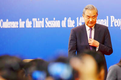
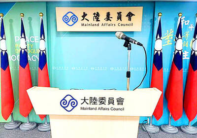
SEPARATE: The MAC rebutted Beijing’s claim that Taiwan is China’s province, asserting that UN Resolution 2758 neither mentions Taiwan nor grants the PRC authority over it The “status quo” of democratic Taiwan and autocratic China not belonging to each other has long been recognized by the international community, the Mainland Affairs Council (MAC) said yesterday in its rebuttal of Beijing’s claim that Taiwan can only be represented in the UN as “Taiwan, Province of China.” Chinese Minister of Foreign Affairs Wang Yi (王毅) yesterday at a news conference of the third session at the 14th National People’s Congress said that Taiwan can only be referred to as “Taiwan, Province of China” at the UN. Taiwan is an inseparable part of Chinese territory, which is not only history but

CROSSED A LINE: While entertainers working in China have made pro-China statements before, this time it seriously affected the nation’s security and interests, a source said The Mainland Affairs Council (MAC) late on Saturday night condemned the comments of Taiwanese entertainers who reposted Chinese statements denigrating Taiwan’s sovereignty. The nation’s cross-strait affairs authority issued the statement after several Taiwanese entertainers, including Patty Hou (侯佩岑), Ouyang Nana (歐陽娜娜) and Michelle Chen (陳妍希), on Friday and Saturday shared on their respective Sina Weibo (微博) accounts a post by state broadcaster China Central Television. The post showed an image of a map of Taiwan along with the five stars of the Chinese flag, and the message: “Taiwan is never a country. It never was and never will be.” The post followed remarks

INVESTMENT WATCH: The US activity would not affect the firm’s investment in Taiwan, where 11 production lines would likely be completed this year, C.C. Wei said Investments by Taiwan Semiconductor Manufacturing Co (TSMC, 台積電) in the US should not be a cause for concern, but rather seen as the moment that the company and Taiwan stepped into the global spotlight, President William Lai (賴清德) told a news conference at the Presidential Office in Taipei yesterday alongside TSMC chairman and chief executive officer C.C. Wei (魏哲家). Wei and US President Donald Trump in Washington on Monday announced plans to invest US$100 billion in the US to build three advanced foundries, two packaging plants, and a research and development center, after Trump threatened to slap tariffs on chips made