For anyone on board the train looking out the window, it must have been a strange sight. The same foreigner stood outside waving at them four different times within ten minutes, three times on the left and once on the right, his face getting redder and sweatier each time.
At this unique location, it’s actually possible to beat the train up the mountain on foot, though only with extreme effort. For the average hiker, the Dulishan Trail is still a great place to get some exercise and see the train — at least once — as it makes its way up this record-breaking part of the Alishan Forest Railway.
Zhangnaoliao Station (樟腦寮站) is the starting point for this hike.
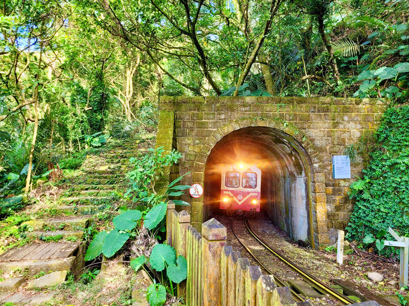
Photo: Tyler Cottenie
Tickets on the Alishan Forest Railway from Chiayi station to Zhangnaoliao are very hard to secure as they must be purchased in person and usually sell out as soon as they become available 12 days in advance. Some tickets are, however, set aside each morning; arrive at the ticket counter outside Chiayi Station right when they open at 8am to try your luck.
It’s nevertheless best to drive yourself there by car or scooter, or alternatively take bus 7313 from Chiayi station (7:25am, 8:55am, 10:55am) to the Abaquan stop (阿拔泉) and walk up to Zhangnaoliao.
Follow the signs for Dulishan (獨立山) until you reach the zero kilometer marker beside a large parking lot above and behind the station.
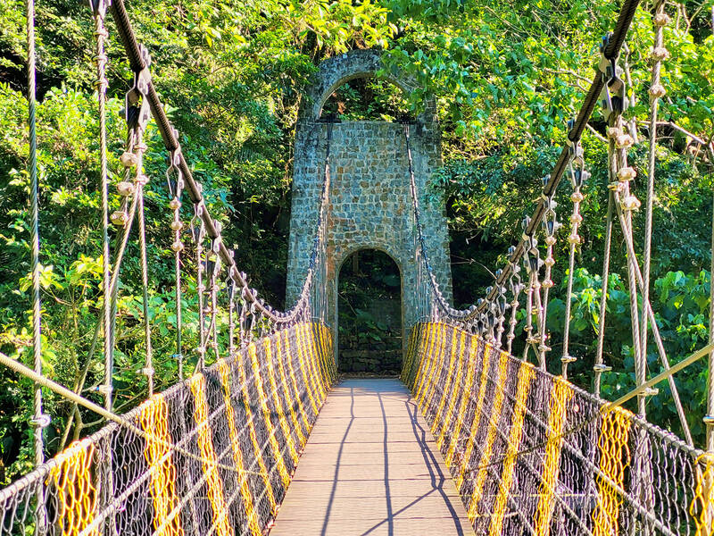
Photo: Tyler Cottenie
Only a few minutes into the walk, there’s a junction with one trail heading uphill to the left, and one going downhill to the right. This is the start and end of the loop, so you can go either way, but this article will describe a counter-clockwise hike, starting with a right turn here.
The first encounter with the tracks, and your first chance to get a close-up view of the train, is only a few minutes later. Here, the trail crosses a creek on a suspension bridge right beside where the railroad crosses the same creek.
SPIRALING UP
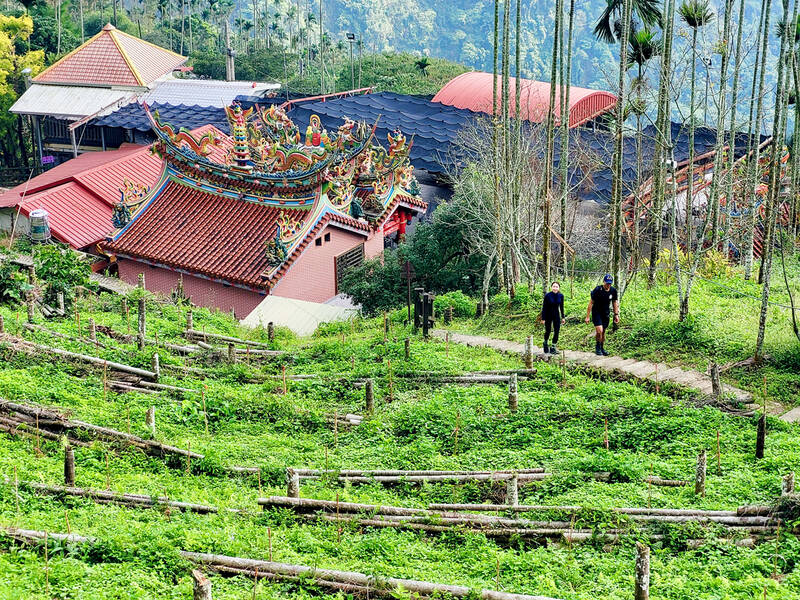
Photo: Tyler Cottenie
After the bridge, the trail starts to ascend steeply. Traction is not a problem even in wet weather, as there are well-built wooden stairs, but it is tiring. In just 600 meters of forward distance, the trail ascends 200 meters to rejoin the railroad as it emerges from the last tunnel of the Dulishan Spiral. Since trains cannot make such a rapid ascent, this mountain presented a major challenge during the construction of the Alishan Forest Railway nearly 120 years ago.
The solution was to draw the ascent out over 4.5 kilometers — that’s seven and a half times the distance that the hiking trail covers. To accomplish this with the limited space available on this small mountain, engineers wrapped this section of track up into a spiral route that wound its way through a series of 11 tunnels and crossed over itself 10 times along the way. This incredible feat has earned the Alishan Forest Railway a place in the Guinness World Records for having the “longest railway spiral.”
The present-day hiking trail is an excellent way to get to know this engineering marvel up close, as it crosses or parallels the spiral route at six different places. As you climb the hill, you will reach the railroad again near the end of its first loop around the mountain. Up the tracks to the left is a concrete platform that gives an excellent bird’s-eye view of the train when it is passing near Zhangnaoliao Station below. Wait here around 10:10am, 11:00am, 2:40pm or 3:40pm to see this.
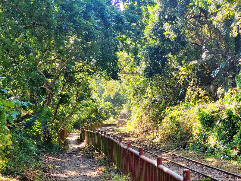
Photo: Tyler Cottenie
After crossing the tracks, the trail continues uphill until it crosses the railway again during its second loop around the mountain. The trail continues uphill again until it reaches a junction. The right fork is an alternate route to the summit of Duli Mountain, or Dulishan, but to stay close to the railroad, take the left fork. Soon you will see the railroad again, at the point where it exits Tunnel No. 10.
If you’ve managed to follow the train all the way uphill, you may be surprised to see the train moving in the opposite direction here. After the second loop, the railway passes Dulishan Station (獨立山站) and then crosses immediately back to the west side of the mountain through Tunnel No. 10, instead of making another loop around the east side. This is the start of its final maneuver before reaching the ridge, a figure-eight, and is the reason the direction appears reversed.
AT THE TOP
Just a short distance uphill from here, the trail rejoins the railroad at the top of the ridge. The train’s direction appears reversed once again, as it has just completed the bottom loop of the figure-eight. This point is also an important junction on the hiking trail.
Across the tracks, a left turn puts you on a path that parallels the railway along the ridge. By turning right instead and walking uphill for 15 minutes, hikers can reach the summit of Duli Mountain, one of Taiwan’s Small 100 Peaks. Instead of turning left or right, it’s also possible to continue straight ahead down the back side of the mountain to reach the railroad again at Dulishan Station. About 25 meters below the ridge, this station marks the start of the figure-eight route. Washrooms with running water are available here.
Once you’ve done all of the above, you have seen the Dulishan spiral from every possible angle and even bagged a peak on the side; now it’s time to relax. If you’re at Dulishan Station, continue past the station uphill to the ridge, cross the tracks, and then follow the signs uphill for Fengtianyan (奉天岩).
Not five minutes uphill, there is a little shop selling food and cold drinks, even on weekdays. Why not stop in and treat yourself to a serving of local fig jelly? Few things are as thirst-quenching on a hot day, especially after running most of the way up the mountain. Even if you’ve just walked up at a normal pace like a sane person, fig jelly always hits the spot, and the price is right: NT$35 a cup.
TEMPLE TIME
After the shop, keep following the Fengtianyan signs for about 15 minutes to reach the temple of the same name, where you can immerse yourself in rural Taiwanese leisure culture at its finest. On any day of the week, the place is bustling with hikers who’ve completed the walk up sitting down for a nice meal or tea session at one of the many tables set up in front of the temple.
Not only is there a hot and cold water machine here, there is also a large kitchen with gas stoves and an abundance of donated pots, pans, utensils and even full tea sets, all free for public use. Bring your instant noodles, your tea leaves or a full meal: you can prepare it all here.
Sit down to the beautiful mountain view, sip on a cup of oolong and enjoy a chat with your hiking partners or the friendly locals.
To get back to the trailhead, head back down toward the railway and look for a junction just before the tracks with a sign pointing toward Zhangnaoliao Station. This route starts off on a farm road but soon turns into a forest trail. It’s a gentler slope than the Dulishan trail and a much nicer way to descend. Soon enough, you’ll reach the first intersection of the day, completing the loop.
The afternoon train back to Chiayi leaves Dulishan at 3:31pm and Zhangnaoliao at 3:44pm. If there’s space left, more likely on weekdays, you may be able to ride the train all the way down. Otherwise, you can catch bus 7321 from the Abaquan stop at 5:20pm.

In the March 9 edition of the Taipei Times a piece by Ninon Godefroy ran with the headine “The quiet, gentle rhythm of Taiwan.” It started with the line “Taiwan is a small, humble place. There is no Eiffel Tower, no pyramids — no singular attraction that draws the world’s attention.” I laughed out loud at that. This was out of no disrespect for the author or the piece, which made some interesting analogies and good points about how both Din Tai Fung’s and Taiwan Semiconductor Manufacturing Co’s (TSMC, 台積電) meticulous attention to detail and quality are not quite up to

April 21 to April 27 Hsieh Er’s (謝娥) political fortunes were rising fast after she got out of jail and joined the Chinese Nationalist Party (KMT) in December 1945. Not only did she hold key positions in various committees, she was elected the only woman on the Taipei City Council and headed to Nanjing in 1946 as the sole Taiwanese female representative to the National Constituent Assembly. With the support of first lady Soong May-ling (宋美齡), she started the Taipei Women’s Association and Taiwan Provincial Women’s Association, where she

It is one of the more remarkable facts of Taiwan history that it was never occupied or claimed by any of the numerous kingdoms of southern China — Han or otherwise — that lay just across the water from it. None of their brilliant ministers ever discovered that Taiwan was a “core interest” of the state whose annexation was “inevitable.” As Paul Kua notes in an excellent monograph laying out how the Portuguese gave Taiwan the name “Formosa,” the first Europeans to express an interest in occupying Taiwan were the Spanish. Tonio Andrade in his seminal work, How Taiwan Became Chinese,

Mongolian influencer Anudari Daarya looks effortlessly glamorous and carefree in her social media posts — but the classically trained pianist’s road to acceptance as a transgender artist has been anything but easy. She is one of a growing number of Mongolian LGBTQ youth challenging stereotypes and fighting for acceptance through media representation in the socially conservative country. LGBTQ Mongolians often hide their identities from their employers and colleagues for fear of discrimination, with a survey by the non-profit LGBT Centre Mongolia showing that only 20 percent of people felt comfortable coming out at work. Daarya, 25, said she has faced discrimination since she