While global attention is finally being focused on the People’s Republic of China (PRC) gray zone aggression against Philippine territory in the South China Sea, at the other end of the PRC’s infamous 9 dash line map, PRC vessels are conducting an identical campaign against Indonesia, most importantly in the Natuna Islands.
The Natunas fall into a gray area: do the dashes at the end of the PRC “cow’s tongue” map include the islands? It’s not clear. Less well known is that they also fall into another gray area. Indonesia’s Exclusive Economic Zone (EEZ) claim and continental shelf claim are not coincident in that area, as Australian security and defense expert Euan Graham pointed out on X (Twitter) last week. “China knows how to exploit a grey zone when it sees one,” he observed.
The Natuna Regency, the Indonesian administrative name for the region, contains “at least” 154 islands, 127 of which are uninhabited, according to Wikipedia. As always, after supplying some facts to orient the reader, Wiki then moves on to the history, where, in the very first sentence, we are treated to an amazing nonsense artifact: “The Natuna Islands were discovered by I-Tsing in 671 A.D. and mentioned throughout his notes in A Record of Buddhist Practices Sent Home from the Southern Sea.”
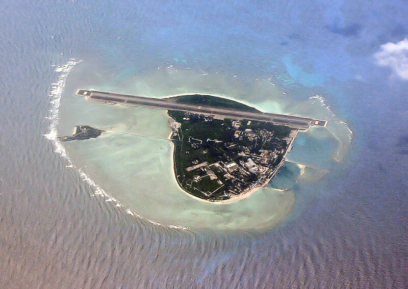
Photo courtesy of Wikimedia Commons
I-Tsing (Yijing, 義淨), was a Tang Dynasty Buddhist scholar whose travel writings are important sources of information on the routes between India, China and the kingdoms of what is today Malaysia and Indonesia. He is famed for translating Buddhist texts, and for his commentaries on the state of Buddhism in the places he visited. He did not, however, “discover” anything. He was a monk, incapable of operating a ship or recording navigational information. The only difference between himself and the cargo aboard the vessels he rode on was that he was alive.
Anyone who wants to see what Wikipedia would be like if PRC propagandists had unlimited access need only visit Quora, which on matters related to the PRC is nigh-on useless, thanks to the 50-cent brigade. But despite Wikipedia’s generally sturdy editing work, pro-PRC statements and frames like this creep in. As the first sentence in the “history” section, it subtly supports the PRC claim to the area by attributing “discovery” to someone from China.
YIJING’S ACCOUNTS
Photo courtesy of Wikimedia Commons
As history the statement is absurd. Tang-era ships did not play the routes between India, China and southeast Asia. In the seventh century that was the domain of Near Eastern and Indian seafarers who had been part of extensive trade networks across seas of India and southeast Asia for at least a millennium. Yijing himself records that he left from Guangzhou aboard a Persian vessel and sailed to Srivijaya in what is now Indonesia. Along the way he kept running notes on the locations he passed, on their customs and their adherence to Buddhism. It is obvious from both his notes and his occasional references that the islands he passed were inhabited (as many are today).
Yijing’s notes are merely the oldest surviving written account of the area. Since tablets with writing from the Srivijaya kingdom are known from shortly after his time, it is highly plausible that even that state is simply the luck of archaeological practice. Sooner or later earlier inscribed objects discussing the area will be unearthed.
However, there must have been written accounts galore. The loss of so much of the Greco-Roman classical corpus is generally mourned, but the loss of writings from southeast Asia must have been just as great. Yijing records the habits of Buddhist monks wherever he went, describing in minute detail their variations in habits. Buddhism is a text-based religion, and must have been transmitted from literate to literate. With the thousand monks then in residence, Yijing himself extols Srivijaya as an excellent place to study Buddhist texts. All lost, today.

Photo courtesy of Wikimedia Commons
Yijing admits he is uncertain of the size of the area, and remarks that the merchants who regularly plied these waters would know. Scholars and dilettantes of our own age tend to focus on the literati of a bygone age, a subtle class solidarity that reaches across time, distorting what it touches. Yet, also lost is another enormous corpus of records: the rutters used by local pilots to navigate.
A rutter is a set of notes a navigator compiles about routes, landmarks, the sea and its currents and tides, the sea bottom, astronomy, climate, wind conditions and other aspects of navigation and port activities. The word in English comes down from Arabic, indicating the importance of Arab rutters in the development of similar western texts. The Persian ship that took Yijing to Indonesia must have had a set of rutters describing the route and its associated land masses in detail, developed over numerous voyages.
HISTORICAL PROPAGANDA
Photo courtesy of Wikimedia Commons
These conclusions about Yijing are also true of every other “historical link” invented or appropriated by the PRC for its historical propaganda. The PRC often cites the scribblings of its literati in their travels as legitimating texts for its expansionist claims, appealing to the historical bias that treats literati as a superior source of knowledge. The truth is that the Chinese literati, landlubbers traveling long-established routes, were always the last to know of a place. Centuries before them, the masters of the ships on which they traveled already knew the routes and recorded them in their rutters. Most of these have been lost.
One of the ways our social biases toward the literate and toward history as the story of the upper class help the PRC erase the past is that we forget the existence of documents like rutters, and the non-Han sailors who compiled them (going all the way back to the Austronesians and Negritos who first settled southeast Asia). PRC discourse wants us to focus on the Chinese and their activities, which not only moves them into prominence, but conceals the expert navigators who carried them and their trade goods from one place to another.
Since mid-October a Norwegian survey ship contracted by Indonesia has been in the Natunas performing a fossil fuel survey, and the PRC coast guard has parked a ship there to shadow it. Indonesian navy vessels have been unable to eject the PRC ships and clear the area. Each time the Indonesian authorities have reported ejecting them, the PRC coast guard has returned. As the Asia Maritime Transparency Initiative (AMTI) observes, though PRC vessels and the Indonesian coast guard have clashed before, this is the first time the Indonesian government has been so prompt in releasing information on PRC activities.
Expect the Natunas, and Yijing’s name, to come up more often.
Notes from Central Taiwan is a column written by long-term resident Michael Turton, who provides incisive commentary informed by three decades of living in and writing about his adoptive country. The views expressed here are his own.

What was the population of Taiwan when the first Negritos arrived? In 500BC? The 1st century? The 18th? These questions are important, because they can contextualize the number of babies born last month, 6,523, to all the people on Taiwan, indigenous and colonial alike. That figure represents a year on year drop of 3,884 babies, prefiguring total births under 90,000 for the year. It also represents the 26th straight month of deaths exceeding births. Why isn’t this a bigger crisis? Because we don’t experience it. Instead, what we experience is a growing and more diverse population. POPULATION What is Taiwan’s actual population?

For the past five years, Sammy Jou (周祥敏) has climbed Kinmen’s highest peak, Taiwu Mountain (太武山) at 6am before heading to work. In the winter, it’s dark when he sets out but even at this hour, other climbers are already coming down the mountain. All of this is a big change from Jou’s childhood during the Martial Law period, when the military requisitioned the mountain for strategic purposes and most of it was off-limits. Back then, only two mountain trails were open, and they were open only during special occasions, such as for prayers to one’s ancestors during Lunar New Year.

A key feature of Taiwan’s environmental impact assessments (EIA) is that they seldom stop projects, especially once the project has passed its second stage EIA review (the original Suhua Highway proposal, killed after passing the second stage review, seems to be the lone exception). Mingjian Township (名間鄉) in Nantou County has been the site of rising public anger over the proposed construction of a waste incinerator in an important agricultural area. The township is a key producer of tea (over 40 percent of the island’s production), ginger and turmeric. The incinerator project is currently in its second stage EIA. The incinerator

It sounded innocuous enough. On the morning of March 12, a group of Taichung political powerbrokers held a press conference in support of Deputy Legislative Speaker Johnny Chiang’s (江啟臣) bid to win the Chinese Nationalist Party (KMT) primary in the Taichung mayoral race. Big deal, right? It was a big deal, one with national impact and likely sent shivers down the spine of KMT Chairwoman Cheng Li-wun (鄭麗文). Who attended, who did not, the timing and the messaging were all very carefully calibrated for maximum impact — a masterclass in political messaging. In October last year, the Democratic Progressive Party (DPP)