Shanggang Park (商港公園) marks the journey’s beginning. I’m not alone. Families are picnicking on the grass. Across the street, Garden Bicycle (田園小站) is doing a roaring trade renting four-seater velos to tourists also keen to pedal along Bali District’s (八里) section of the Golden Riverside Cycling Path (金色水岸自行車道).
Beyond Taipei Harbor, the sun and clouds conduct a strange dance over the Taiwan Strait. It’s not clear yet, what kind of weather will win the day. Shafts of sunlight spear Guanyin Mountain (觀音山) — an extinct volcano named after the Buddhist Goddess of Mercy — but the road ahead remains cloaked in a soft sea mist.
WATERFRONT RIDE
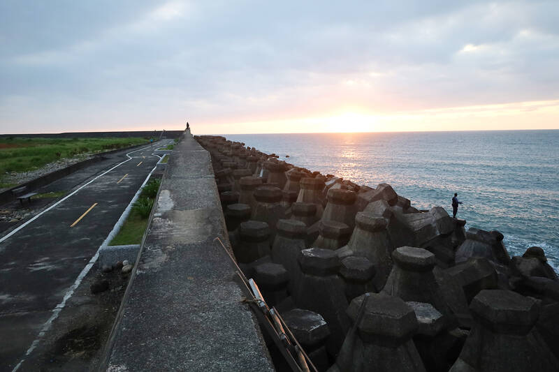
Photo: Thomas Bird, Taipei Times
The first two kilometers make for an easy ride down a tree-shaded cycle path. I’m conscious, as I roll beyond Shihsanhang Museum (十三行博物館) that an iron-smelting community had once persisted here, which archaeologists believe would have been the wealthiest in prehistoric Taiwan.
Contemporary Bali, by contrast, appears provincial and undeveloped by the standards of Taipei.
At the headland, the Tamsui river estuary is blocked from view by the Wazihwei Nature Reserve (挖子尾自然保護區), “an important ecological nursery for mangroves” that is home to “animals, such as egrets, mudskippers and fiddler crabs,” according to New Taipei City’s tourism Web site.
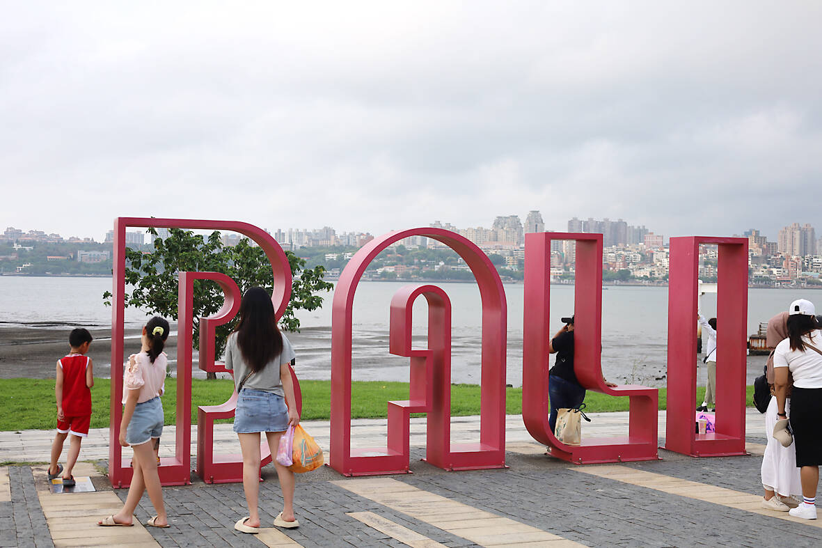
Photo: Thomas Bird, Taipei Times
I make my first detour here, cycling past a small Taoist shrine and some tumbledown fisherman cottages, to get a closer look at the mangrove forest.
Amid the insect hiss, I eventually come within view of the water. The path ends unceremoniously amid some tall river grass and blue-painted fishing boats beached on the surrounding mudflats. The eyes painted on the boats appear to be staring at the mighty Danjiang Bridge (淡江大橋), an epic engineering project, which, once completed, will sew-up the mouth of Tamsui River, connecting Bali to the ever-expanding northern Taiwan conurbation. For now at least, things remain feral and untamed.
After fighting off some stray beach dogs, I double back to find the bikeway again, which veers through a particularly picturesque part of the coastal reserve — a two-lane track that bisects the mangroves and is shaded by verdant overgrowth.
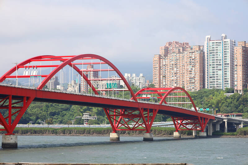
Photo: Thomas Bird, Taipei Times
At the end of the stretch, there’s a small pavilion that has been strategically erected for people to sit and enjoy the vista at “one of the most important ecological points of the mangrove swamp,” as a tourist sign reads. I learn that, because Bali District is sheltered by Guanyin Mountain, a unique habitat has evolved, one rich in avian and sea life, although now threatened by rubbish carried down-stream along the Tamsui River.
Mother nature’s realm soon submits to the habitat of humankind once I cycle past The Shack (野菇屋), a river-facing restaurant that sells slices of New York-style pizza. From here on, the bikeway winds its way through a tourist-orientated waterfront area, with parks for kids, selfie-spots for honeymooners and landscaped gardens for old folk to stroll through.
After rolling over a rainbow-colored boardwalk, I’m slowed to a snail’s pace by the crowds amassing around Bali Old Street (八里老街), where a plethora of exotic seafoods are on sale from various stalls.
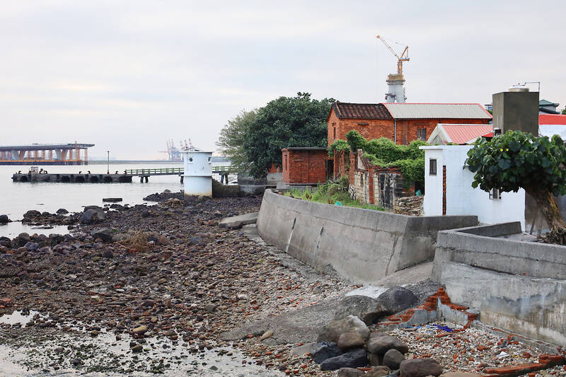
Photo: Thomas Bird, Taipei Times
Opposite, people have gathered to get the boat to Tamsui from the Bali Wharf and I’m tempted to follow suit. A short boat ride would cut the journey’s distance significantly.
Beyond this commercial quarter, however, the crowds dissipate and it’s pleasant to ride again, cycling along a superbly tarmacked bike path through coast-hugging Micang Park (米倉公園).
OVER THE BRIDGE
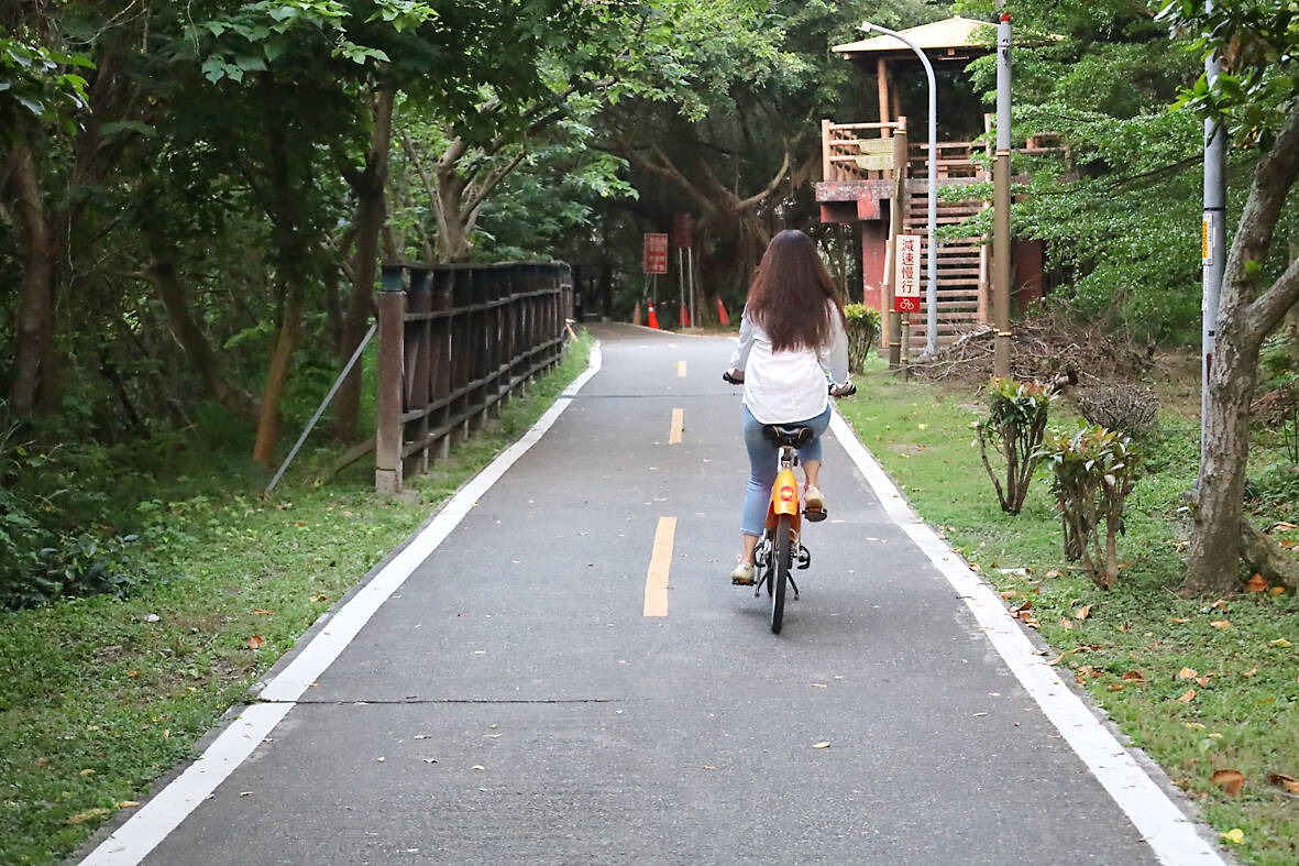
Photo: Thomas Bird, Taipei Times
Along the route there are a few bespoke cafes offering free bottle-filling stations for thirsty cyclists and I make a pitstop at Shuifurong Cafe (水芙蓉Cafe) for a much needed fruit juice before tackling the second leg of the ride.
Guandu Bridge (關渡大橋) is a 165-meter long, red-colored arch bridge that supports both Provincial Highway 15 as well as two narrow cycle lanes. Crossing the river, then, is both an exhilarating and unnerving experience, as trucks whizz by within inches of cyclist’s handlebars. The salt flavored-wind blows fast and heavy in the middle of the river, providing some extra push once I roll down the slipway onto the Tamsui-side of the Golden Riverside Cycling Path.
I’ve still got 17 kilometers to go, but adrenaline is on my side and I make good time cycling through this lovely stretch of bikeway hemmed between the overland metro line and the Tamsui River Mangrove Nature Reserve.
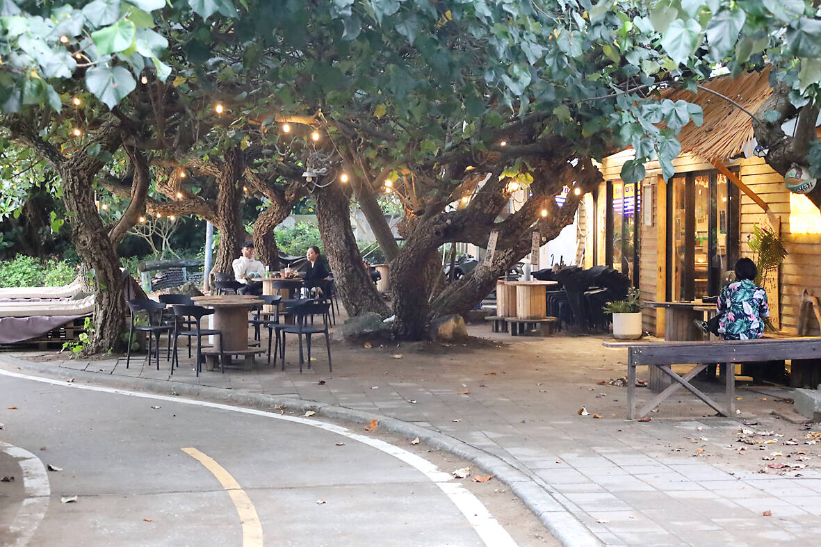
Photo: Thomas Bird, Taipei Times
Tamsui’s old stationhouse, which was originally built by the Japanese and opened in 1901, marks the beginning of a history-imbued corridor. The bikeway follows the riverside promenade at first, before snaking around the Tamsui Customs Wharf (淡水海關碼頭) — the last remaining pier of Qing Dynasty vintage.
Just across the road, Fort San Domingo (紅毛城) looks over the waterfront, an imposing, hillside castle-like structure founded by Spanish in 1629. It was later occupied by the Dutch, and latterly, the British, who made it into a consulate building in 1867.
Beyond the fort, the bikeway follows the road then winds its way between some crumbling old seaside dwellings, coming in view of the estuary once again. It’s easy to see why the “mouth of northwest Taiwan” was such a hotly contested area over the centuries, although there’s little maritime activity as I ride by. But for a few pleasure cruisers and day sailors, the water is calm and untroubled as the fading sunlight.
Photo: Thomas Bird, Taipei Times
ALONG THE COAST
At Fisherman’s Wharf (漁人碼頭), I make another detour, cycling around a harbor dotted by sailing boats and flanked by yet more seafood restaurants.
The route then traces the edge of Shalun Beach (沙崙海水浴場) where some newlyweds are getting their wedding photos taken in front of the surf.
It’s easy to get lost here, as the bikeway mandates a sharp turn down a narrow path just before you get to the Luye Equestrian Center (綠野馬術文創園區).
Thankfully, I follow my nose and the smell of the horses leads me in the right direction, an auspicious turn of luck, because this also demarks the most scenic part of the bikeway.
I roll past a few beachfront cafes until I get to the Gongsitian River (公司田溪), which apparently got its name, meaning “company fields river” as the surrounding area was owned by the Dutch East India Company centuries past.
The bridge over the river is, alas, exclusively for light rail, so the bikeway tacks inland before returning to the coast at Ocean Palace, a condominium complex that looks to be the high-rise habitat of New Taipei City’s well-to-do.
The final kilometer of the Golden Riverside Cycling Path loops around some coastal scrub land and follows the seawall. This marks the end of the ride, but not the journey.
Some fisherman have left ladders against the wall which you can climb to learn why the bikeway is branded “golden.”
The sunsetting across the strait is truly magnificent and has duly attracted a fair few people to mount the wall and enjoy nature’s spectacle.
To the south I see Guanyin Mountain in Bali District. It’s as if “the goddess of mercy” has followed me all the way.
The Democratic Progressive Party (DPP), Chinese Nationalist Party (KMT), and the country’s other political groups dare not offend religious groups, says Chen Lih-ming (陳立民), founder of the Taiwan Anti-Religion Alliance (台灣反宗教者聯盟). “It’s the same in other democracies, of course, but because political struggles in Taiwan are extraordinarily fierce, you’ll see candidates visiting several temples each day ahead of elections. That adds impetus to religion here,” says the retired college lecturer. In Japan’s most recent election, the Liberal Democratic Party lost many votes because of its ties to the Unification Church (“the Moonies”). Chen contrasts the progress made by anti-religion movements in
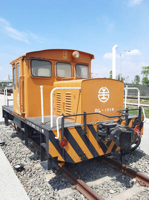
Taiwan doesn’t have a lot of railways, but its network has plenty of history. The government-owned entity that last year became the Taiwan Railway Corp (TRC) has been operating trains since 1891. During the 1895-1945 period of Japanese rule, the colonial government made huge investments in rail infrastructure. The northern port city of Keelung was connected to Kaohsiung in the south. New lines appeared in Pingtung, Yilan and the Hualien-Taitung region. Railway enthusiasts exploring Taiwan will find plenty to amuse themselves. Taipei will soon gain its second rail-themed museum. Elsewhere there’s a number of endearing branch lines and rolling-stock collections, some

Last week the State Department made several small changes to its Web information on Taiwan. First, it removed a statement saying that the US “does not support Taiwan independence.” The current statement now reads: “We oppose any unilateral changes to the status quo from either side. We expect cross-strait differences to be resolved by peaceful means, free from coercion, in a manner acceptable to the people on both sides of the Strait.” In 2022 the administration of Joe Biden also removed that verbiage, but after a month of pressure from the People’s Republic of China (PRC), reinstated it. The American

Chinese Nationalist Party (KMT) legislative caucus convener Fu Kun-chi (傅?萁) and some in the deep blue camp seem determined to ensure many of the recall campaigns against their lawmakers succeed. Widely known as the “King of Hualien,” Fu also appears to have become the king of the KMT. In theory, Legislative Speaker Han Kuo-yu (韓國瑜) outranks him, but Han is supposed to be even-handed in negotiations between party caucuses — the Democratic Progressive Party (DPP) says he is not — and Fu has been outright ignoring Han. Party Chairman Eric Chu (朱立倫) isn’t taking the lead on anything while Fu