Keelung often conjures up images of narrow streets, rainy skies, damp concrete buildings and a busy shipping port. Just outside the main harbor, however, lie recreational opportunities that highlight the beautiful coastal scenery and rich history that Keelung has to offer. Relax on the beach, climb up to a remote lighthouse, observe the myriad shapes created by sandstone erosion along the coast or learn about the various groups that have made their homes here over the centuries, all within minutes of downtown.
KEELUNG ISLET
Looking out from Keelung’s coast, a small island is visible about 5km out to sea, the result of volcanic eruptions a million years ago that also created Keelung Mountain next to Jiufen (九份). This outcropping of rock, Keelung Islet (基隆嶼), is now open to tourists and makes for a nice day trip for those who enjoy getting off the beaten path.
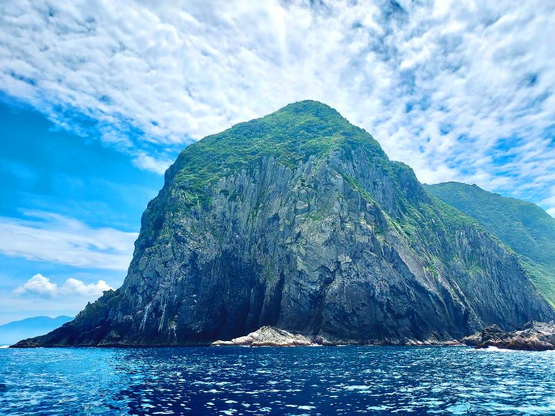
Photo: Tyler Cottenie
Access to the island has not always been easy. Before 2001, Keelung Islet was a restricted military area; since 2001, the islet has experienced a closure lasting 5 years due to typhoon damage; and when it is open to tourists, the season only lasts from around April to October. Tourists can reach the island via private boats leaving from Bisha Harbor (碧砂漁港), a few kilometers east of Keelung Harbor. Advance reservations are required but spots are plentiful.
After a 30-minute boat ride, the boat docks at Keelung Islet’s large concrete wharf and passengers are free to explore the island. The coastal path leads halfway around the island and includes a tunnel bored straight through the rock. Many species of birds and insects make their home on Keelung Islet, as well as over 140 species of plants. The great biodiversity on this small plot of land can be attributed to its proximity to the mainland and the variety of ecological niches provided by its steep terrain. Visitors in April or May will be treated to white lilies in bloom, while visitors in September or October can see the spindly yellow blooms of the golden spider lily.
Branching off the coastal path is the main attraction of the islet: a path that climbs right to the top. In the summer or in midday heat this climb can be taxing — make sure to bring lots of water — but the views at the top are worth it. Surrounded by deep blue waters on all sides 182 meters below, the islet offers a commanding view of Taiwan’s northern coast, just a few kilometers away, from Bitoujiao to Keelung Harbor to Yehliu and beyond. Also up here is Taiwan’s first fully solar-powered lighthouse, constructed in 1980.
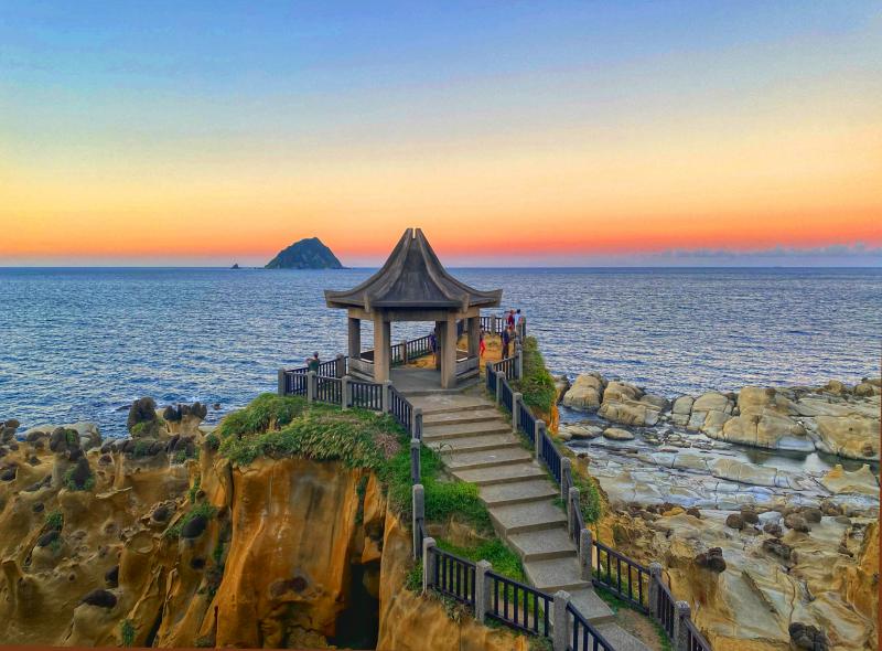
Photo courtesy of IG@andy200962
On the return trip, some packages include fresh fish soup for guests, and a side trip to Elephant Rock. This basalt formation is usually visited on shore near Shenao (深澳) off Highway 2, but the boat trip offers a much better viewing angle, with the entire animal in view. The entire Keelung Islet excursion, including Elephant Rock, is usually under four hours.
HEPING ISLAND PARK
If you manage to book an early trip to Keelung Islet, and the weather is nice, why not spend the rest of your afternoon at Heping Island Park? Guided ecotours, a sandy beach, seaside cafes and swimming are all on offer here. Heping Island is located just 2km west of Bisha Harbor, protecting the main entrance to Keelung Harbor. The island has been connected to the mainland by bridge since 1934, when the first bridge between Taiwan and an outer island was constructed in the same location as the modern bridge.
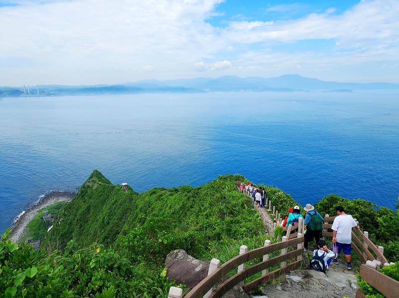
Photo: Tyler Cottenie
Though Keelung is infamous for its high annual rainfall and isn’t the first place that comes to mind as a beach destination, on sunny days Heping Island Park is a nice place to soak up some sun and play in the water, especially for families. There is space to build sandcastles, there is a kiddie pool with shallow water, and the main swimming pool — though it is too deep for non-swimmers — is protected from any sort of waves or currents and supervised by lifeguards. This saltwater pool is surrounded by concrete walls, with the pool’s water being continuously exchanged with water from the wider ocean through small concrete channels. Bring your goggles and snorkel as there is even some marine life to see inside the pool.
If the weather isn’t great or the beach isn’t your thing, there is still more to do in the park. The geology here is very similar to nearby Yehliu Geopark (野柳地質公園), with unevenly eroded sandstone creating fantastical shapes set against the backdrop of the Pacific. The contrast of the orange and brown rocks, lush green vegetation and blue ocean makes for stunning photographs. A walking trail open to all park visitors gives easy access to these sights, while also passing by two sites of historical significance.
DIGGING DEEPER
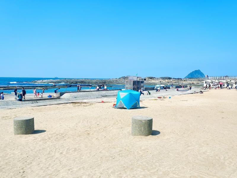
Photo: Tyler Cottenie
Heping Island has been home to many groups of foreigners throughout its colored history. The Spanish were the first Europeans to have a presence here, and the excavated stone foundation of their Todos los Santos church is now a tourist site on the island, outside the park itself.
The Dutch were the next colonial power to take control of the island. From the walking trail inside the park, a cave known as the “Dutch Cave” is visible in the sandstone below. This cave once had Dutch writing etched on the rock inside, left by Dutch colonists hiding out here before their final expulsion from Formosa.
Around the corner at the end of the trail is a statue of a Ryukyuan fisherman. During the period of Japanese rule, this island was home to a community of hundreds of people from the Ryukyu Islands (now Okinawa) who were warmly welcomed by the local community, as the Ryukyuans shared their more effective fishing techniques with them. After the Japanese surrender, many of the Ryukyuans continued to live on the island, only to find themselves persecuted, or executed, during the 228 Incident. This statue commemorates the legacy of these foreigners in Taiwan.
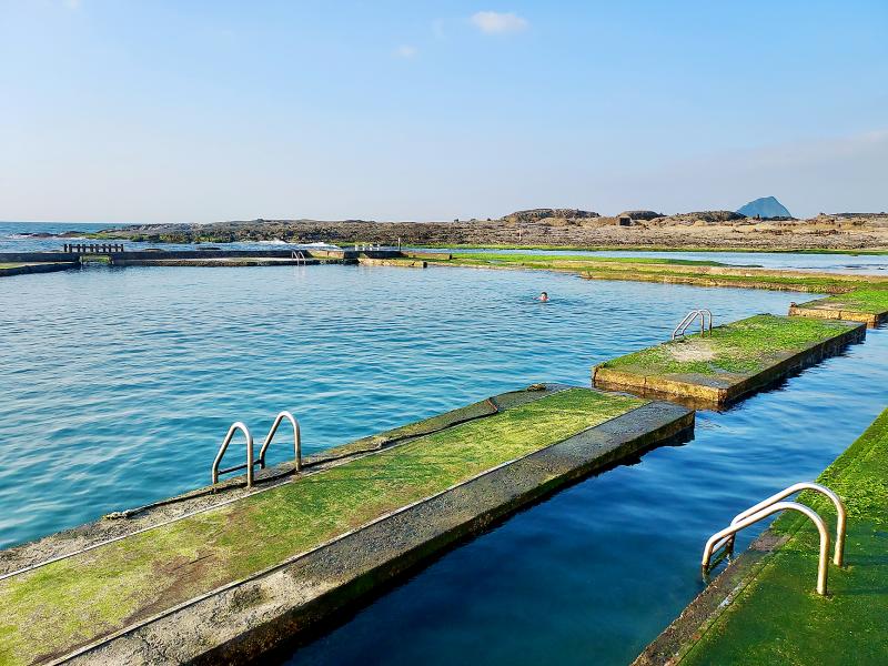
Photo: Tyler Cottenie
Free tours of Heping Island Park are offered once or twice daily (included with price of admission), but for those wanting to explore the park more in depth, there are several paid guided tour options available that must be booked a week in advance. A large portion of the eroded sandstone landscape is off-limits to ordinary visitors but can be viewed up close with a guide. There are other tours that focus on the intertidal zone, and there’s an option to enter the park before opening hours to see the sunrise framed by the green “tofu rocks” of Alabao Bay, sandstone that has been eroded in a regular square pattern and covered with green seaweed.
Since the park’s management has been tendered to a private for-profit business, the park not only offers a variety of guided tours, but also contains a gift shop and restaurants at the visitor center. Sipping a drink on the patio overlooking the park and the northern coast of Taiwan is a fantastic way to cap off a day of exploring Keelung’s coastal sights.

Photo: Tyler Cottenie
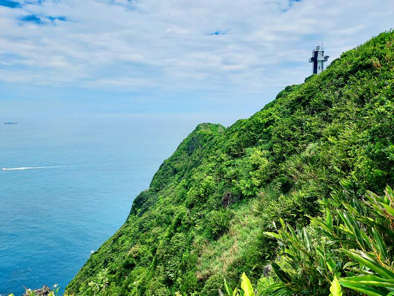
Photo: Tyler Cottenie

Three big changes have transformed the landscape of Taiwan’s local patronage factions: Increasing Democratic Progressive Party (DPP) involvement, rising new factions and the Chinese Nationalist Party’s (KMT) significantly weakened control. GREEN FACTIONS It is said that “south of the Zhuoshui River (濁水溪), there is no blue-green divide,” meaning that from Yunlin County south there is no difference between KMT and DPP politicians. This is not always true, but there is more than a grain of truth to it. Traditionally, DPP factions are viewed as national entities, with their primary function to secure plum positions in the party and government. This is not unusual

More than 75 years after the publication of Nineteen Eighty-Four, the Orwellian phrase “Big Brother is watching you” has become so familiar to most of the Taiwanese public that even those who haven’t read the novel recognize it. That phrase has now been given a new look by amateur translator Tsiu Ing-sing (周盈成), who recently completed the first full Taiwanese translation of George Orwell’s dystopian classic. Tsiu — who completed the nearly 160,000-word project in his spare time over four years — said his goal was to “prove it possible” that foreign literature could be rendered in Taiwanese. The translation is part of

Mongolian influencer Anudari Daarya looks effortlessly glamorous and carefree in her social media posts — but the classically trained pianist’s road to acceptance as a transgender artist has been anything but easy. She is one of a growing number of Mongolian LGBTQ youth challenging stereotypes and fighting for acceptance through media representation in the socially conservative country. LGBTQ Mongolians often hide their identities from their employers and colleagues for fear of discrimination, with a survey by the non-profit LGBT Centre Mongolia showing that only 20 percent of people felt comfortable coming out at work. Daarya, 25, said she has faced discrimination since she

The other day, a friend decided to playfully name our individual roles within the group: planner, emotional support, and so on. I was the fault-finder — or, as she put it, “the grumpy teenager” — who points out problems, but doesn’t suggest alternatives. She was only kidding around, but she struck at an insecurity I have: that I’m unacceptably, intolerably negative. My first instinct is to stress-test ideas for potential flaws. This critical tendency serves me well professionally, and feels true to who I am. If I don’t enjoy a film, for example, I don’t swallow my opinion. But I sometimes worry