Kaohsiung’s National Sun Yat-sen University (國立中山大學) has one of the most idyllic settings of any university in Taiwan. Away from the bustling city center on the far side of Monkey Mountain, also known as Chaishan (柴山) and Shoushan (壽山), the buildings in this tranquil setting are blessed with unobstructed views of Kaohsiung Harbor and the Taiwan Strait, not to mention glorious sunsets. In fact, this area was so beautiful that former president Chiang Kai-Shek (蔣介石) established a villa here for his personal use, preventing the average citizen from entering the area for decades.
After his passing in 1975, the Kaohsiung City Government began developing the area for recreation, re-establishing the swimming beach from the Japanese days, and setting up a zoo nearby, among other improvements. With the establishment of the university in 1980, the zoo animals had to be moved up the mountain, but sports facilities were then added to the list of reasons for people to visit the area. Chiang’s Villa has even been opened as a tourist attraction.
Behind the university campus, however, one narrow paved road continues to wind its way farther and farther away from the city center, parallel to but high above the shoreline. Eventually, the road dead-ends at a military checkpoint. Tucked away in this isolated corner of Kaohsiung just before the checkpoint is Chaishan Village (柴山部落), an eclectic mix of residences, farms, cafes and temples, first populated centuries ago by Aborigines and later Han immigrants.
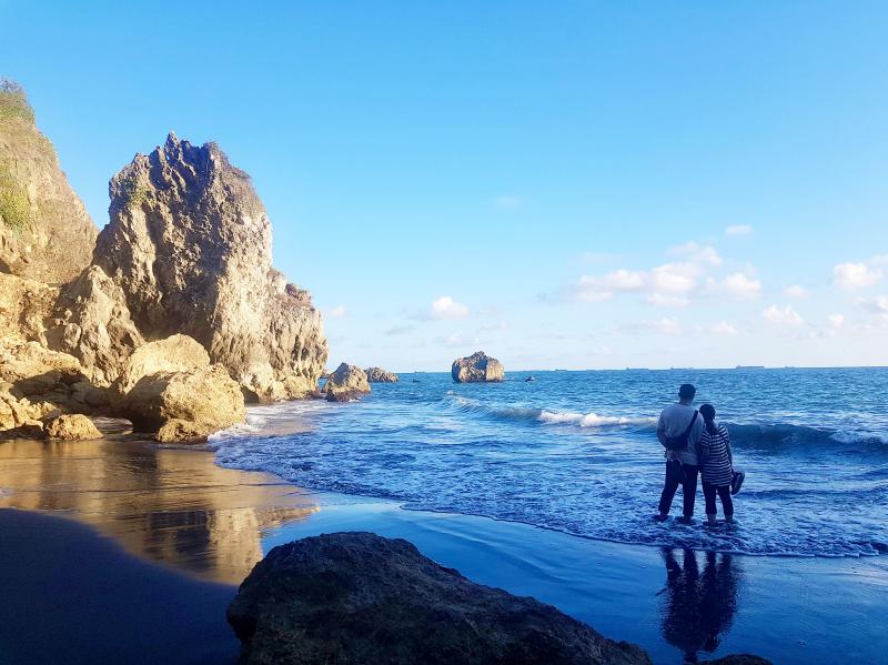
Photo: Tyler Cottenie
THE CHAISHAN COASTLINE
The Chaishan Alangyi trail takes visitors from the edge of the university campus down to the far end of this settlement, all along the shoreline. Like its namesake in Pingtung County, the Alangyi Historic Trail (阿朗壹古道), this trail follows relatively unspoiled coastline from one trailhead to an exit elsewhere. Also like its namesake, it is very exposed and best hiked in the winter, or at the very least not during the midday heat. Unlike its namesake, this trail is entirely unofficial, unmaintained and unregulated: No permits or guide are needed, but proceed at your own risk.
Just after the last university building, there is a trail behind a chain link fence on the left side of the main road that descends to a large sandy beach. This “Secret Beach,” as it is commonly known among locals, is a favorite spot for sunbathing, socializing and swimming. “No swimming” signs are posted (sporadically enforced and consistently ignored) and deaths have occurred here when the sea gets rough. For those uncomfortable with the water or the lack of supervision, the beach is nevertheless a fine place to while away an afternoon, with the greenery of the mountain at your back and the blue of the sea in front of you. There is even a natural cold spring here, allowing visitors to rinse off sand and salt before heading home. This beach is nice enough that it may entice some would-be trail walkers to abandon their plans and settle down for a day in the sun. Few would regret such a choice.
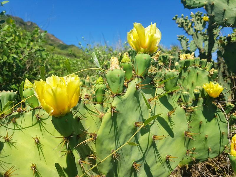
Photo: Tyler Cottenie
For those who wish to continue, head north along the coast. The trail alternates between sharp coral rock (wear good walking shoes with a hard sole), loose gravel and sand. At high tide, careful footing is needed to hop from stone to stone in a few places, but the trail is mainly on dry ground.
Along the way, the trail passes an abandoned pillbox, a concrete reminder that this entire mountain from peak to shoreline was once a protected military area. Surrounding this pillbox is a healthy community of cacti, decorated with yellow flowers and red fruit, thriving in Kaohsiung’s hot sun. Grab a photo in, on or around this military relic, and grab some shade inside if the weather is hot: the remainder of the trail is quite exposed. Don’t forget to bring plenty of water when planning a walk on this trail.
Speaking of things being exposed, visitors to the next part of the trail may be in for a surprise. North of the pillbox is another long section of black sandy beach. This is the real “Secret Beach,” according to many. With a half-hour walk in required from either side, some feel this affords them enough privacy to go ahead and expose parts of their body that they wouldn’t on any other beach. Indeed, this is Kaohsiung’s very own (unofficial) nude beach. Due to the heavier traffic in recent years from people walking the Chaishan Alangyi, this practice is not as common as it once was, but it has far from disappeared.
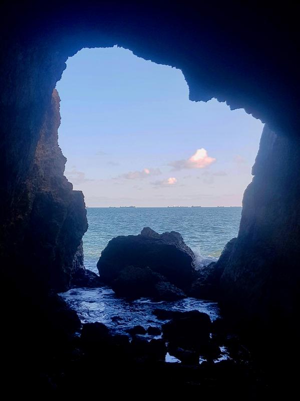
Photo: Tyler Cottenie
HUMAN SETTLEMENT
Continuing north, the trail passes a perfectly eroded vertical wall of yellow soil before reaching another perfectly vertical wall, this time made of concrete. This retaining wall marks your arrival at the Chaishan Fishing Pier. Just ahead, there are concrete tetrapods protecting the small harbor from erosion. Pipe rafts and fishing paraphernalia are scattered on the beach, indicating a small but still active fishing community.
Many walkers call it quits here and head back up to the main road through the village. There is a mix of abandoned, semi-abandoned and well-maintained buildings here, but nothing much in the way of new structures. Property rights exist in a legal gray area here, with the land under lease from the government, not owned and new construction not technically allowed. This, coupled with the fact that the whole mountain is sliding downhill at a rate of around 10 cm per year in places, makes it an unattractive location for development. Still, there are a number of restaurants and coffee shops in the area with expansive patios and fantastic ocean views. Enjoying an ice-cold beverage while watching the sunset is a great way to end a hike on the Chaishan Alangyi.
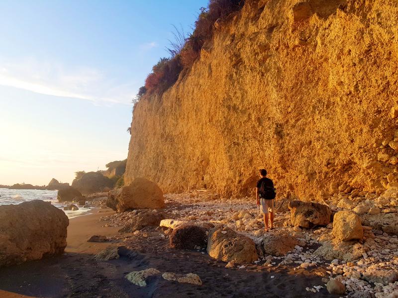
Photo: Tyler Cottenie
The village is a common ending (or starting) point for the hike, but it is also possible to stay on the shoreline and continue further north. The coastal path goes through a large field of tetrapods half-buried in the soil, protecting a military facility up the hill, before arriving at another black sand beach, the most private one of all. A vertical wall of rock at the north end of the beach makes for a definitive end to the trail, while a small trail uphill from the south end of the beach gives access to a paved road above. Follow this up to a T-intersection, and turn right to reach the main road.
There is one final location that is not connected to the Chaishan Alangyi but deserves honorable mention. Turning left instead of right at the T-intersection mentioned above and going downhill, one can reach the coast on a paved road. This location, known unofficially as Dazihran (大自然, meaning “nature” or “the great outdoors”) is a favorite getaway for Sun Yat-sen University students. It features a cafe with ocean views, a pillbox that has fallen into the ocean, a small hill with a trail to the top and an Instagram hot spot: a tunnel eroded through this hill by the ocean (access behind a fence once again). It is a nice bonus destination at the end of a walk along the Chaishan Alangyi.
Getting In and Out

Photo: Tyler Cottenie
From the Sizihwan MRT stop, take Bus 99 to the College of Liberal Arts stop (southern trailhead) or the Shanhai Temple stop (village trailhead). If exiting the trail at the northernmost trailhead, walk south 300m along the main road to reach the first bus stop for Bus 99. Walking between southern and northern trailheads takes 30 minutes on the main road and 1.5 hours along the coast.
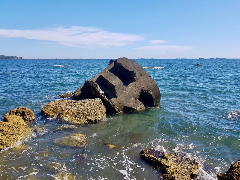
Photo: Tyler Cottenie
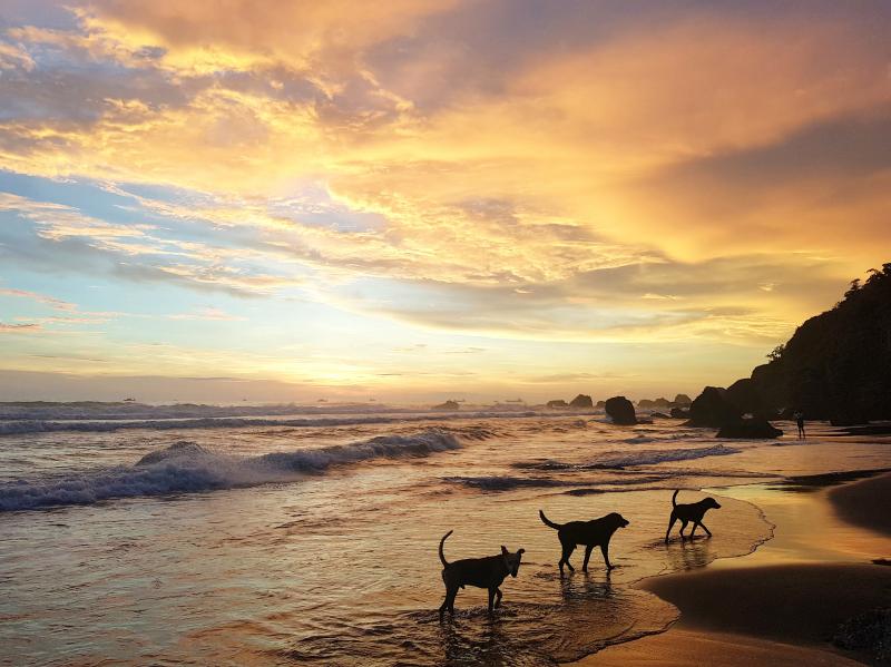
Photo: Tyler Cottenie

If you are a Western and especially a white foreign resident of Taiwan, you’ve undoubtedly had the experience of Taiwanese assuming you to be an English teacher. There are cultural and economic reasons for this, but one of the greatest determinants is the narrow range of work permit categories that exist for Taiwan’s foreign residents, which has in turn created an unofficial caste system for foreigners. Until recently, laowai (老外) — the Mandarin term for “foreigners,” which also implies citizenship in a rich, Western country and distinguishable from brown-skinned, southeast Asian migrant laborers, or wailao (外勞) — could only ever
Sept. 23 to Sept. 29 The construction of the Babao Irrigation Canal (八堡圳) was not going well. Large-scale irrigation structures were almost unheard of in Taiwan in 1709, but Shih Shih-pang (施世榜) was determined to divert water from the Jhuoshuei River (濁水溪) to the Changhua plain, where he owned land, to promote wet rice cultivation. According to legend, a mysterious old man only known as Mr. Lin (林先生) appeared and taught Shih how to use woven conical baskets filled with rocks called shigou (石笱) to control water diversion, as well as other techniques such as surveying terrain by observing shadows during

In recent weeks news outlets have been reporting on rising rents. Last year they hit a 27 year high. It seems only a matter of time before they become a serious political issue. Fortunately, there is a whole political party that is laser focused on this issue, the Taiwan Statebuilding Party (TSP). They could have had a seat or two in the legislature, or at least, be large enough to attract media attention to the rent issue from time to time. Unfortunately, in the last election, Taiwan People’s Party (TPP) Chairman Ko Wen-je (柯文哲) acted as a vote sink for
This is a film about two “fools,” according to the official synopsis. But admirable ones. In his late thirties, A-jen quits his high-paying tech job and buys a plot of land in the countryside, hoping to use municipal trash to revitalize the soil that has been contaminated by decades of pesticide and chemical fertilizer use. Brother An-ho, in his 60s, on the other hand, began using organic methods to revive the dead soil on his land 30 years ago despite the ridicule of his peers, methodically picking each pest off his produce by hand without killing them out of respect