The degree of a hike’s difficulty is directly proportional to how much conversation people will engage in. Barely a peep, for example, is heard from those summiting Jade Mountain’s main peak (玉山, 3,952m). The steep ascent to the ancient Aboriginal village of Kucapungane (舊好茶, Jiuhaocha) in Taitung County finds only the most experienced energized enough to weave a tale or utter an anecdote. A hike along the Jinshueiying Ancient Trail (浸水營古道, 1,490m), however, with its moderate inclines and long stretches of mostly horizontal path, ensures that hikers will engage in all kinds of banter.
And that’s the problem — if you are on the hunt for wildlife. Voices make noise. Noise startles animals. And there are plenty of exotic animals — pangolins and Reeves muntjac (a type of small deer), Formosan rock macaques and civet cats — to be found on the Jinshueiying Trail. Stay with a group, though, and good luck getting close to any.
Jinshueiying stretches 47km over the Central Mountain Range from Pingtung County’s Fangliao Township (枋寮) to Dawu Township (大武) in Taitung County. The trail was popularized by husband-and-wife Yang Nan-chun (楊南郡) and Hsu Ju-lin (徐如林), amateur adventurers who have done much to interest a whole generation of Taiwanese to leave the city and explore the history of the many Aboriginal trails that criss-cross the nation.

Photo: Noah Buchan, Taipei Times
Signs indicating historical anecdotes punctuate the well-maintained and easily traversable path, and point to the many wanderers who have used it over the centuries for the purposes of trade, migration and leisure. Although the trail is easily navigatable, getting to the trailhead on the Taitung side is a little difficult, so going with a group is recommended.
Our party began on the Taitung side and hike 15km of the trail to Pingtung. After disembarking at Guzihlin Bridge (姑仔崙) we set out on the seven-hour hike, our large group breaking off into smaller groups, as we yappily navigate the well-laid trail.
ANCIENT TRAIL
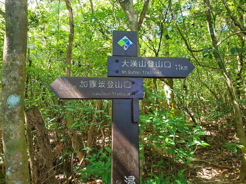
Photo: Noah Buchan, Taipei Times
A Story of the Jinshuiying National Trail (浸水營古道:一條走過五百年的路), written by the aforementioned couple, tells us that the trail dates back at least five centuries, locating its existence as part of domestic and international trade routes.
Puyuma and Paiwan Aborigines transported goods from Pingtung to Taitung and back again. A Portuguese shipwreck in 1582 off the coast of Fangliao is said to be the first contact with local inhabitants and Europeans, when the sailors developed trade relations with the Makatao, a lowland Pingpu (平埔) Aboriginal community.
Decades later, the Dutch established a base in what is today’s Tainan, after the Chinese kicked them out of the outlying island of Penghu. They traded with Siraya, an Aboriginal community that wore necklaces made from gold, which was rumored to be sourced from Taitung. Like many before and after, the Dutch traveled the Jinshueiying Trail in search of riches, though it’s not clear if they ever found the gold that they were looking for.
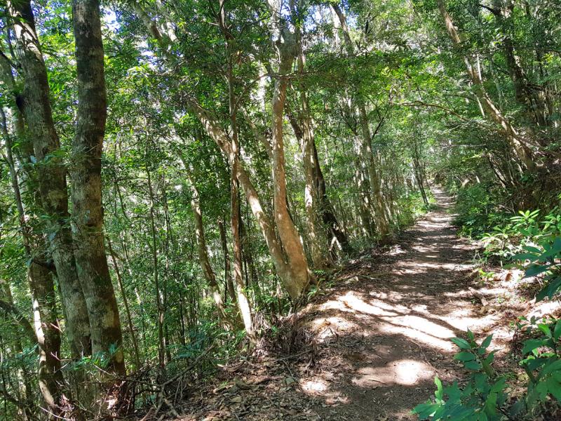
Photo: Noah Buchan, Taipei Times
The trail has had many monikers over the centuries. During the Dutch era, it was called the “trail of escape” because they used it to escape from the troops of Ming Dynasty warlord Cheng Cheng-kung (鄭成功, also known as Koxinga) in 1661, fleeing to Taitung, where they remained for nine months.
In 1721, Ming-dynasty loyalist Chu Yi-kwei (朱一貴) fled along the trail after starting an uprising against the Qing Dynasty. A larger rebellion 50 years later found Lin Shuang-wen (林爽文) fleeing down the same trail, Qing troops in pursuit.
As Chinese migrants increasingly encroached on Aboriginal land, conflicts broke out between the two groups. This led to the Qing’s “open up the mountains and pacify the savages” (開山撫番) campaign, which saw the first checkpoints being built along the trail. Chushui Hill Camp (出水坡駐在所, 716m), just over two hours from the trailhead, was built in 1882 and manned by 30 soldiers.
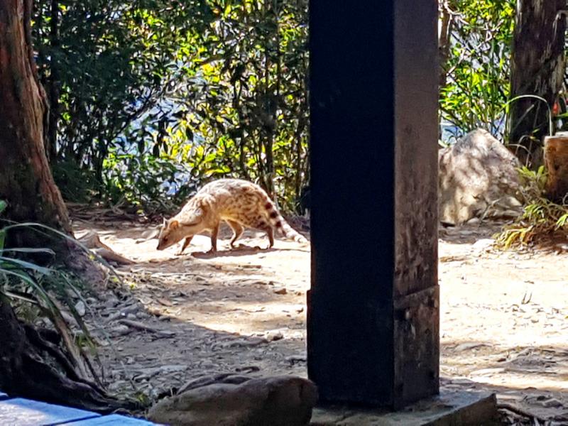
Photo: Noah Buchan, Taipei Times
The Japanese continued the Qing’s subjugation policy after Taiwan became its colony in 1895. In 1919, the Japanese modified Chushui Hill Camp into a police station with offices and barracks — this after Paiwan Aborigines and people from the Guzihlun indigenous community attacked another police station, killing its inhabitants and burning it down.
Only the foundation of these former colonial outposts remain — though the county governments have been kind enough to erect shelters where hikers can rest in the shade. It’s at Chushui Hill that our group has agreed to stop for our first break and a bite to eat.
ON THE PATH
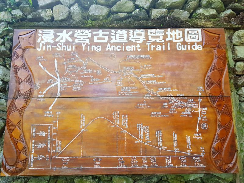
Photo: Noah Buchan, Taipei Times
I am the first to arrive at Chushui. For 45 minutes after crossing Guzihlin Bridge and entering the trailhead proper, I remain with my group of four, the easy hike putting us into a philosophical frame of mind, chatting about previous hikes and hikes yet to be, the benefit of carrying two poles instead of one, growing old and the natural anger middle-aged men have to overcome to achieve a kind of nirvana in their frail dotage. I then take off on my own in the hopes of catching a glimpse of a wild animal.
Don’t be concerned about getting lost. The trail is marked every 500m with posts — if you walk 15 minutes without encountering one, you’ve probably gone in the wrong direction and should turn back.
Jinshuei literally means “soaking wet,” and it’s best to check the weather forecast, not only on the day you travel, but the days leading up to your hike because the trail can get extremely muddy after even a few minutes rainfall.
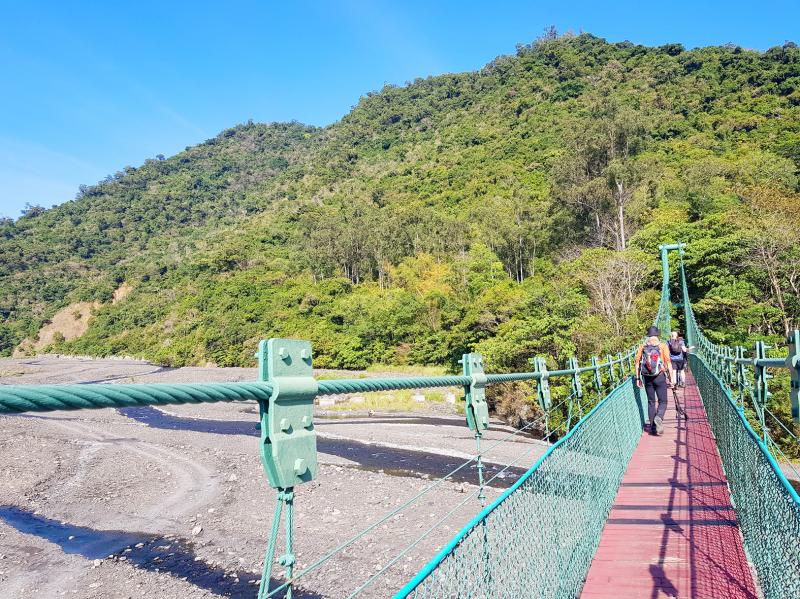
Photo: Noah Buchan, Taipei Times
As our group had fallen behind, I spend the next 30 minutes passing other groups. A few minutes beyond the remains of a charcoal kiln, one of many that used to exist here for the purposes of turning wood into coal and sold as fuel, I hear something crashing in the underbrush off to my right.
I am making more noise than I should, so I slow down considerably, controlling my breathing. I am careful to avoid breaking sticks or stepping on dried leaves. After hearing the aforementioned commotion, I climb over a slight embankment and catch a glimpse of an animal running off. A muntjac, I think, but can’t be certain.
The two large groups of hikers that I encounter at Chushui camp doesn’t bode well for wild animal encounters. Striking up a conversation with one group, I learn that they are from Taitung and make the trek on a weekly basis. They add that there should be several of these groups on the trail.
While at Chushui, I clamber up a tiny path to look at the remnants of a Shinto shine, another reminder of Japan’s former presence.
After the rest of my group catches up, I take off again. Unlike other mountain trails, Jinshueiying isn’t known for its open mountain vistas. Instead, the canopy envelops you and focuses your attention to the sounds and sights of the forest.
But no animals — no visual sightings, anyway. Plenty of noise from birds above and animals trouncing through the forest. By the time I reach Gulibabaonuo Police Station Rest Stop (古里巴保諾駐在所休息點, 860m) 30 minutes later, I’m somewhat resigned to the fact that I won’t be seeing any wild animals.
IT’S A CIVET!
And then it happens. While daydreaming under a shelter at Gulibabaonuo, a civet cat scurries out from the underbrush, nervously scuttling back and forth, nibbling on crumbs dropped from the granola bars and sandwiches of the many hikers who have rested here. As I’ve spent the previous few hours practicing stealth, I manage not to disturb the civet as I draw closer and photograph its lithe body motioning back and forth. Soon I hear voices in the distance and as they grow louder, the civet is lost to the forest once again.
As I pass around video of the civet cat, everyone produces their own story about the time they saw a pangolin (“but we probably won’t see any because they are nocturnal”), macaque or other exotic animal. So there is plenty to see on the path, but it seems catching a glimpse of a wild animal has as much to do with luck as it does to do with stealth.
Satisfied that I’ve seen a wild animal, I no longer feel the need to be separated from the group. Yet I’m enjoying the solitude so much, I spend the hour that it takes to reach Jinshueiying Police Station (浸水營駐在所, 1320m) and its western part (浸水營步道西段, 1426m) by myself.
For the last hour and more it’s all downhill to the trailhead on the Pingtung County side. From here, I fall back in a few from my group and spend the last leg of the trip alternately talking and taking photographs of the far-off mountains, visible through the dense jungle.

In the March 9 edition of the Taipei Times a piece by Ninon Godefroy ran with the headine “The quiet, gentle rhythm of Taiwan.” It started with the line “Taiwan is a small, humble place. There is no Eiffel Tower, no pyramids — no singular attraction that draws the world’s attention.” I laughed out loud at that. This was out of no disrespect for the author or the piece, which made some interesting analogies and good points about how both Din Tai Fung’s and Taiwan Semiconductor Manufacturing Co’s (TSMC, 台積電) meticulous attention to detail and quality are not quite up to

April 21 to April 27 Hsieh Er’s (謝娥) political fortunes were rising fast after she got out of jail and joined the Chinese Nationalist Party (KMT) in December 1945. Not only did she hold key positions in various committees, she was elected the only woman on the Taipei City Council and headed to Nanjing in 1946 as the sole Taiwanese female representative to the National Constituent Assembly. With the support of first lady Soong May-ling (宋美齡), she started the Taipei Women’s Association and Taiwan Provincial Women’s Association, where she

It is one of the more remarkable facts of Taiwan history that it was never occupied or claimed by any of the numerous kingdoms of southern China — Han or otherwise — that lay just across the water from it. None of their brilliant ministers ever discovered that Taiwan was a “core interest” of the state whose annexation was “inevitable.” As Paul Kua notes in an excellent monograph laying out how the Portuguese gave Taiwan the name “Formosa,” the first Europeans to express an interest in occupying Taiwan were the Spanish. Tonio Andrade in his seminal work, How Taiwan Became Chinese,

Mongolian influencer Anudari Daarya looks effortlessly glamorous and carefree in her social media posts — but the classically trained pianist’s road to acceptance as a transgender artist has been anything but easy. She is one of a growing number of Mongolian LGBTQ youth challenging stereotypes and fighting for acceptance through media representation in the socially conservative country. LGBTQ Mongolians often hide their identities from their employers and colleagues for fear of discrimination, with a survey by the non-profit LGBT Centre Mongolia showing that only 20 percent of people felt comfortable coming out at work. Daarya, 25, said she has faced discrimination since she