In a country with one of, if not the highest, concentration of 3,000m peaks in the world you would be forgiven for presuming that it must be a dream destination for mountain biking. Certainly from the 1980s up to the year 2000 there were lots of riders out there, but several major typhoons and changing trends in the bike industry saw off-road riding lose its dominance. Now, that might be changing.
In addition, it beggars belief that there is little by way of government support/infrastructure to improve the environment for those who prefer a dirt road. Living in southern Taiwan I have seen what were once popular mountain biking locations become illegal to access by bike, such as Jinsueiying ancient trail (浸水營古道) from Pingtung to Taitung. That regulation hasn’t completely deterred the more adventurous, but it does come with a certain amount of risk.
Taking the above into account I was surprised to learn that, as of January, the Danda Forest Road (丹大林道) was open to both hikers and cyclists. Perhaps less surprising when you consider that Nantou County is one of the more rural/agricultural counties in Taiwan and opening up to this kind of tourism can provide both employment and revenue to largely indigenous communities where industry has failed to reach.
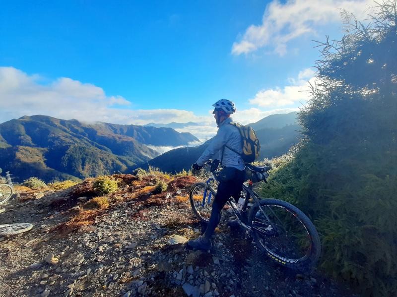
Photo: Mark Roche
THE JOURNEY BEGINS
On the morning of Feb. 14 our group of 12 comprising 10 riders and 2 hikers departed from Kaohsiung at 5am by van. It took around 3 hours to reach Nantou’s Dili village (地利). You follow Provincial Road No. 16 to the end. At the 11.5km marker you cross Sunhai Bridge (孫海橋), which is a temporary river crossing that will see a permanent structure built in the near future.
Once you cross the bridge you are now at 0km marker on the Danda Road. At the 4.5km (elevation 900m) marker you come to a gate where your permit for access will be checked. Cars and motorbikes cannot go beyond this point with the exception of Bunun Aborigines who work in the area.
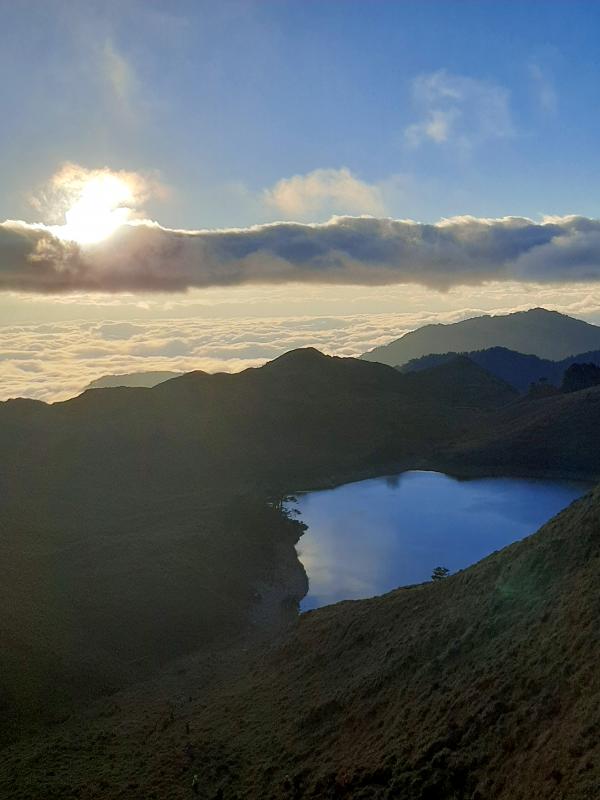
Photo: Mark Roche
Three motorcycles were hired to transport our camping gear, packs and 2 hikers up the mountain allowing those of us on bikes to just carry essentials for the ride. On our first day we had to ride 32km (1,642m elevation gain) to overnight indoors at an abandoned workers’ hostel that was, in former times, bustling and occupied by Taiwan Power Co employees.
(For more of the historical aspect of this road, look for the excellent article researched and written by Tyler Cottenie which appeared in the Dec. 11, 2020 Taipei Times: bit.ly/3vlen62.)
This is a tough ride with only the central and southern cross-island highways coming close in terms of extreme ascent. Friends who had hiked or used motorcycle transport up told me it would be a dream ride. They will never be forgiven. Riding on rough gravel cannot be compared to road – ever. There were times when we were doing what I call “momentum/balance speed:” 3-4km per hour, just fast enough to stop you from falling over. It is also worth pointing out that you are completely exposed to the elements for most of this section.
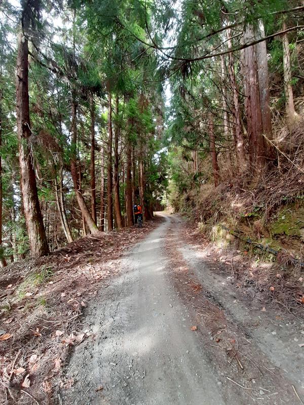
Photo: Mark Roche
I couldn’t believe it when I saw some riders on garden variety mountain bikes, 1.5 slick tires and the rear loaded up with racks and panniers. This is a recipe for disaster. If you don’t want to hire motorbike support, then at least put your money into proper mountain bike specific racks.
In the first 16km alone there is approximately 1,400m of ascent. When the gradient went over 25 percent it was mostly enjoyable walking. Once you get over this part it is a combination of rolling up and down until you reach the 37km marker and your first overnight stop. So far so good.
DAY TWO
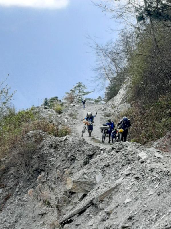
Photo: Mark Roche
We were up at dawn to start riding at first light. After just a few kilometers, this through magnificent forest and three concrete tunnels, we emerged on a ridge line revealing the glory of Taiwan’s central mountain range. Peaks of the longer section hikes were displayed in a panorama that is a sight to behold. The gravel/dirt surface is better the higher up and good progress can be made for the 20km to the top. Arriving at the 51km marker on the road, Cicai Lake (七彩湖, “seven color lake”) comes into view.
On the second night we were camping just above the lake, the temperature dropped by several degrees and proper winter clothing is necessary at any time of year.
Our Aborigine support team cooked up a healthy meal and we were all bedded down before 9pm.
DAY THREE — INCIDENTS
Again an early start with breakfast at 6am and all riders ready for the downhill at 7am. Whatever clothing you have with you should all be put on for this very chilly ride. Caution is advised on the descent as this is about the most inhospitable place to have an accident that is not accessible to an ambulance. In the first half of the descent there is approximately 500m of ascent that will get you warmed up, otherwise there’s not much pedaling to be done.
With clear weather, great mountain scenery and mostly good surface, it’s hard to beat doing a 2,000m descent, but if you take your eyes off the road for a second you risk serious injury. There are long sections of shale rock that will shift as you ride down, so caution is advised.
We had 3 incidents: a rider falling (no serious injury), a broken rear derailleur from a rock strike and one puncture. If you are riding with a group take others into consideration. One rider down presents a headache for all of you. All riders must be confirmed down and safe when you reach the check-point at the exit gate.
IF YOU GO:
Dangers and annoyances: The shale composition of the mountains in this area is in a constant state of flux. Watch out for falling debris and always wear a helmet. The Aboriginal motorbike porters are plying their trade up and down all day transporting passengers and equipment. Do not hinder their progress. I make a point of informing hikers on the high mountain trails to always give way to porters, up or down. The same would apply on the Danda trail. I stop and get out of their way.
Motorbike support can be found on Facebook at (Chinese): bit.ly/3t6kFo1.
Police permits are legally required for trips along the Danda Forest Road. They can be easily obtained online (Chinese): bit.ly/2KzshPp
THE STATS:
Day 1: Time 7.5 hours, distance 32km, elevation gain 1,642m (altitude 2,500m)
Day 2: Time 5 hours, distance 19km, elevation gain 869m (altitude 2,952m)
Day 3: Time 6.5 hours, distance 51km, elevation gain 569m (altitude 900m)
GETTING THERE:
From the west, the ride starts at the end of Provincial Highway 16 beyond Dili Village in Nantou County. Driving your own car is the best transportation option unless you want to ride in. Sufficient time must be allowed for this.

Paul Thomas Anderson’s “One Battle After Another” was crowned best picture at the 98th Academy Awards, handing Hollywood’s top honor to a comic, multi-generational American saga of political resistance. The ceremony Sunday, which also saw Michael B. Jordan win best actor and “Sinners” cinematographer Autumn Durald Arkapaw make Oscar history as the first female director of photography to win the award, was a long-in-coming coronation for Anderson, a San Fernando Valley native who made his first short at age 18 and has been one of America’s most lionized filmmakers for decades. Before Sunday, Anderson had never won an Oscar. But “One Battle
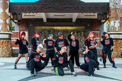
In Kaohsiung’s Indigenous People’s Park (原住民主題公園), the dance group Push Hands is training. All its members are from Taiwan’s indigenous community, but their vibe is closer to that of a modern, urban hip-hop posse. MIXING CULTURES “The name Push Hands comes from the idea of pushing away tradition to expand our culture,” says Ljakuon (洪濬嚴), the 44-year-old founder and main teacher of the dance group. This is what makes Push Hands unique: while retaining their Aboriginal roots, and even reconnecting with them, they are adamant about doing something modern. Ljakuon started the group 20 years ago, initially with the sole intention of doing hip-hop dancing.

What was the population of Taiwan when the first Negritos arrived? In 500BC? The 1st century? The 18th? These questions are important, because they can contextualize the number of babies born last month, 6,523, to all the people on Taiwan, indigenous and colonial alike. That figure represents a year on year drop of 3,884 babies, prefiguring total births under 90,000 for the year. It also represents the 26th straight month of deaths exceeding births. Why isn’t this a bigger crisis? Because we don’t experience it. Instead, what we experience is a growing and more diverse population. POPULATION What is Taiwan’s actual population?

You would never believe Yancheng District (鹽埕) used to be a salt field. Today, it is a bustling, artsy, Kowloon-ish “old town” of Kaohsiung — full of neon lights, small shops, scooters and street food. Two hundred years ago, before Japanese occupiers developed a shipping powerhouse around it, Yancheng was a flat triangle where seawater was captured and dried to collect salt. This is what local art galleries are revealing during the first edition of the Yancheng Arts Festival. Shen Yu-rung (沈裕融), the main curator, says: “We chose the connection with salt as a theme. The ocean is still very near, just a