The Batongguan Traversing Trail (八通關越道路) was built during the Japanese era in order to provide a transportation link between the East and West, and a means to control the Aboriginal population in the mountains. Construction began in 1919 and the entire 125-kilometer project was completed just a year and a half later. It was used until 1944, when the financial strain of the war effort forced its abandonment.
THE WESTERN SECTION
Nowadays, 96 kilometers of the original trail remain, taking hikers from Dongpu (東埔) in Nantou County to Yuli (玉里) in Hualien County. The first few kilometers on the west can be crowded with day tourists walking up to see the stunning Yunlong Waterfall (雲龍瀑布), but the crowds thin out rapidly after this point.
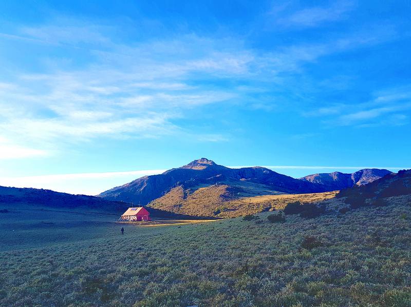
Photo: Tyler Cottenie
The trail continues its slow, steady climb into the mountains. Hiking trails in Taiwan are often steep, following ridgelines and peaks, but the slope of the Batongguan is gentle, as it was designed to allow for cart traffic transporting goods. Around 15 kilometers in is one of the major landmarks and intersections on the trail: the Batongguan Meadow.
This was the site of one of the largest police stations on the Batongguan and played host to Japanese hikers of the past making the trek up to Taiwan’s highest mountain on a side trail that begins here. Nowadays, the outline of the site is still obvious, and the concrete entrance pillars are still standing amid the tall grass. Some hikers still use the same side trail today to reach Jade Mountain, the top of Taiwan. In fact, joining up with the Batongguan via Jade Mountain is an excellent alternative to starting in Dongpu.
The trail continues past an old gold mining site, eventually reaching a beautiful mountain pass covered in short Yushan cane bamboo where the trail crosses over the spine of the Central Mountain Range. Ruins of the Japanese police station Dashuiku (大水窟) can be visited, and a modern shelter constructed by Yushan (Jade Mountain) National Park is available here for hikers’ use.
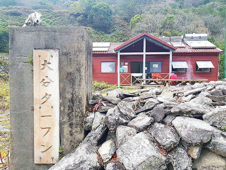
Photo: Tyler Cottenie
THE CHALLENGING EASTERN SECTION
The western portion of the Batongguan is more heavily trafficked, as several of the major 100 Peaks routes make use of it. The eastern section, however, fell rapidly into disrepair after World War II and is still rarely visited. The National Park restored the trail and reopened it in 2005, but this section remains full of narrow sections, cliffs and detours, and as such is not suitable for beginners. However, it is worth exploring as the ruins are more abundant and better preserved on the east side.
The first major attraction here is the Tomas Police Station (托馬斯駐在所). Though no buildings remain, stone walls separating different tiers on the site are very well preserved, and bits of original fencing still stand. Old glass beer and sake bottles from the Japanese era litter the site. There are even ceramic insulators showing where telephone lines used to run, connecting remote mountain police stations with the rest of the island. The site is a testament to the resources the Japanese were willing to invest in controlling and exploiting every remote corner of Taiwan.
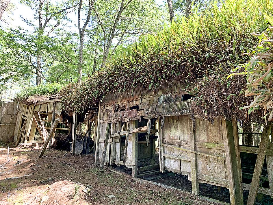
Photo courtesy of Ching-Hsien Hsu
Farther along, the trail disappears in a landslide and a river crossing is required in order to pick up the trail on the other side. This is yet another reason careful planning is required for anyone wanting to walk the whole Batongguan. In fact, earlier this year a solo hiker without GPS got lost at this spot and was only rescued after nine days.
More danger awaits a little farther down the path, just after the Yisila (意西拉) suspension bridges. Have your camera ready as you cross the river here: the newer suspension bridge sits adjacent to the original Japanese bridge, which is now only hanging on by a steel thread. Though the bridge deck is rotted away, the Formosan cypress towers still stand, and it is by far the best preserved of the original bridges on the Batongguan.
After crossing the new bridge, put away your camera, and all other valuables, as you prepare to cross what the author deems the most dangerous section of trail he has seen anywhere in Taiwan. Merely inches wide here, the trail sits on a 70-degree cliff face a hundred meters above the river below, with not a handhold in sight. One wrong step here means certain death, so tread carefully.
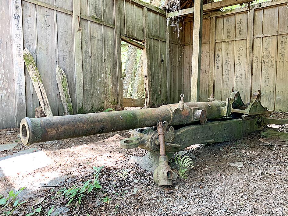
Photo courtesy of Ching-Hsien Hsu
A BUSTLING VILLAGE DEEP IN THE MOUNTAINS
Continuing on, the trail reaches Dafen (大分), where many opt to spend two nights. Besides being a center for Formosan black bear research, there are hot (solar-powered) showers available sporadically in the new hiker’s shelter, and a half-day side trip can be made to the Huabanuo Fort (華巴諾砲台). This fort was the Japanese administration’s way of further extending its tentacles of power into Taiwan’s remote mountains. Unlike all the police stations on the main Batongguan trail, the original wooden structures are still standing here, including one that houses a massive iron cannon.
Dafen itself was once a major settlement, with over a dozen buildings ranging from a clubhouse to a martial arts hall to dormitories. Classes were held here for Bunun youth in the area until the Japanese forced the Aborigines to relocate to lower land in the 1930s. Today, only the concrete ammunition depot still stands, but the multi-tiered layout of the settlement remains relatively clear of vegetation, so it’s possible to walk around and get an appreciation of its size.
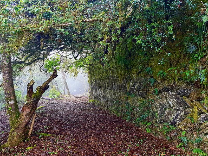
Photo: Tyler Cottenie
Though settlements like Dafen did offer services to the local Aboriginal population, it must be remembered that the main purpose of this trail was in fact to exert control over them and allow the Japanese to quickly quell any further rebellion. Reminders of this fact dot the eastern section of the Batongguan in the form of concrete pillars inscribed with Japanese characters commemorating various officials and policemen who were killed by Bunun in protest against Japanese rule, which prompted the construction of the trail itself.
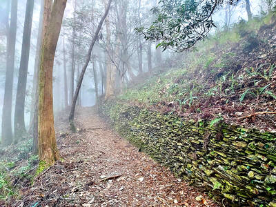
The trail’s condition improves from Dafen eastward as it becomes more heavily trafficked again. This final section is especially picturesque, with the beautifully preserved herringbone-pattern stone walls of Tomiri Police Station (多美麗駐在所) and several towering new suspension bridges. Tourists reappear as one nears civilization again, since the last 14 km of trail are now designated as the Walami Trail (瓦拉米步道), a popular day hike or overnight hike.
The trail suddenly ends in asphalt at the beginning of Provincial Highway 30, which mostly follows the Batongguan route down to Yuli. In the 1970s, this highway was originally slated to cross the island from Yuli all the way to where Provincial Highways 18 and 21 meet near Jade Mountain, passing through Dafen and the Batongguan Meadow along the way. Instead, this part of Taiwan’s wilderness and the old Japanese trail were left intact as part of the planned Yushan National Park. Now, it remains accessible only on foot to those hikers who are prepared to dedicate a week of their lives exploring this historical and natural jewel.
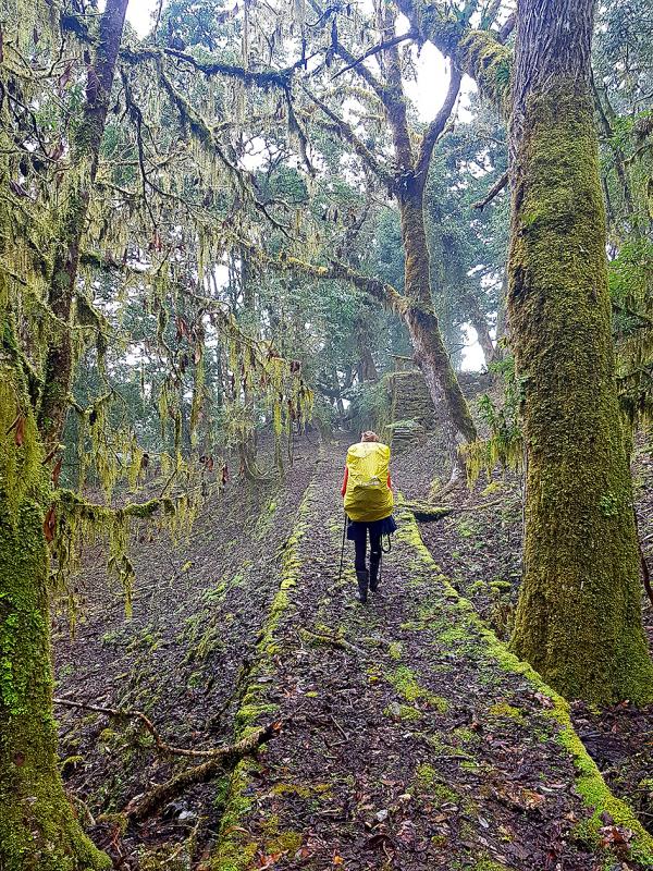
Photo: Tyler Cottenie
The People’s Republic of China (PRC) last week offered us a glimpse of the violence it plans against Taiwan, with two days of blockade drills conducted around the nation and live-fire exercises not far away in the East China Sea. The PRC said it had practiced hitting “simulated targets of key ports and energy facilities.” Taiwan confirmed on Thursday that PRC Coast Guard ships were directed by the its Eastern Theater Command, meaning that they are assumed to be military assets in a confrontation. Because of this, the number of assets available to the PRC navy is far, far bigger

The 1990s were a turbulent time for the Chinese Nationalist Party’s (KMT) patronage factions. For a look at how they formed, check out the March 2 “Deep Dives.” In the boom years of the 1980s and 1990s the factions amassed fortunes from corruption, access to the levers of local government and prime access to property. They also moved into industries like construction and the gravel business, devastating river ecosystems while the governments they controlled looked the other way. By this period, the factions had largely carved out geographical feifdoms in the local jurisdictions the national KMT restrained them to. For example,
The remains of this Japanese-era trail designed to protect the camphor industry make for a scenic day-hike, a fascinating overnight hike or a challenging multi-day adventure Maolin District (茂林) in Kaohsiung is well known for beautiful roadside scenery, waterfalls, the annual butterfly migration and indigenous culture. A lesser known but worthwhile destination here lies along the very top of the valley: the Liugui Security Path (六龜警備道). This relic of the Japanese era once isolated the Maolin valley from the outside world but now serves to draw tourists in. The path originally ran for about 50km, but not all of this trail is still easily walkable. The nicest section for a simple day hike is the heavily trafficked southern section above Maolin and Wanshan (萬山) villages. Remains of

Shunxian Temple (順賢宮) is luxurious. Massive, exquisitely ornamented, in pristine condition and yet varnished by the passing of time. General manager Huang Wen-jeng (黃文正) points to a ceiling in a little anteroom: a splendid painting of a tiger stares at us from above. Wherever you walk, his eyes seem riveted on you. “When you pray or when you tribute money, he is still there, looking at you,” he says. But the tiger isn’t threatening — indeed, it’s there to protect locals. Not that they may need it because Neimen District (內門) in Kaohsiung has a martial tradition dating back centuries. On