Oil prices yesterday were close to an overnight record above US$110 a barrel as investors looked to commodities as a safe haven against the US dollar's slide.
In Asia, the dollar sank to a 12-year low against the yen and hit a record low against the euro amid concerns about the flagging US economy. Many analysts believe the greenback's decline is the reason crude futures have surged to new records in 11 of the past 12 sessions, despite the fact that crude supplies have risen 10.2 percent since early January.
CRUDE FUTURES
Crude futures offer a hedge against a falling dollar, and oil futures bought and sold in dollars are more attractive to foreign investors when the dollar is weak.
"Oil and other commodities have an intrinsic value so that to the extent that the US dollar depreciates, [oil] becomes relatively cheaper in terms of other currencies, such as the euro," said David Moore, a commodity strategist with the Commonwealth Bank of Australia in Sydney. "So you get an adjustment to compensate for that effect."
OIL SUPPLIES
Oil prices initially dropped on Wednesday in New York trading after the US Energy Information Administration said crude supplies rose 6.2 million barrels last week, more than three times the 1.6 million barrels forecast by analysts surveyed by Dow Jones Newswires. But buyers quickly returned to the market.
Light, sweet crude for delivery next month fell US$0.12 to US$109.80 a barrel in electronic trading on the New York Mercantile Exchange by late afternoon in Singapore. It hit US$110.12 a barrel earlier in the session, just below Wednesday's record trading high of US$110.20 a barrel.

SECURITY: As China is ‘reshaping’ Hong Kong’s population, Taiwan must raise the eligibility threshold for applications from Hong Kongers, Chiu Chui-cheng said When Hong Kong and Macau citizens apply for residency in Taiwan, it would be under a new category that includes a “national security observation period,” Mainland Affairs Council (MAC) Minister Chiu Chui-cheng (邱垂正) said yesterday. President William Lai (賴清德) on March 13 announced 17 strategies to counter China’s aggression toward Taiwan, including incorporating national security considerations into the review process for residency applications from Hong Kong and Macau citizens. The situation in Hong Kong is constantly changing, Chiu said to media yesterday on the sidelines of the Taipei Technology Run hosted by the Taipei Neihu Technology Park Development Association. With

CARROT AND STICK: While unrelenting in its military threats, China attracted nearly 40,000 Taiwanese to over 400 business events last year Nearly 40,000 Taiwanese last year joined industry events in China, such as conferences and trade fairs, supported by the Chinese government, a study showed yesterday, as Beijing ramps up a charm offensive toward Taipei alongside military pressure. China has long taken a carrot-and-stick approach to Taiwan, threatening it with the prospect of military action while reaching out to those it believes are amenable to Beijing’s point of view. Taiwanese security officials are wary of what they see as Beijing’s influence campaigns to sway public opinion after Taipei and Beijing gradually resumed travel links halted by the COVID-19 pandemic, but the scale of

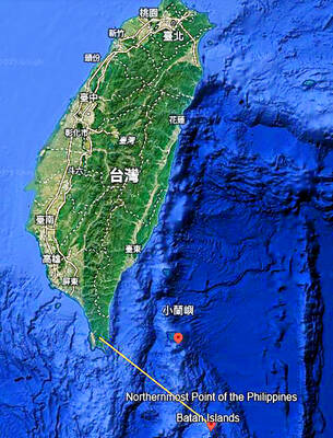
A US Marine Corps regiment equipped with Naval Strike Missiles (NSM) is set to participate in the upcoming Balikatan 25 exercise in the Luzon Strait, marking the system’s first-ever deployment in the Philippines. US and Philippine officials have separately confirmed that the Navy Marine Expeditionary Ship Interdiction System (NMESIS) — the mobile launch platform for the Naval Strike Missile — would take part in the joint exercise. The missiles are being deployed to “a strategic first island chain chokepoint” in the waters between Taiwan proper and the Philippines, US-based Naval News reported. “The Luzon Strait and Bashi Channel represent a critical access

Pope Francis is be laid to rest on Saturday after lying in state for three days in St Peter’s Basilica, where the faithful are expected to flock to pay their respects to history’s first Latin American pontiff. The cardinals met yesterday in the Vatican’s synod hall to chart the next steps before a conclave begins to choose Francis’ successor, as condolences poured in from around the world. According to current norms, the conclave must begin between May 5 and 10. The cardinals set the funeral for Saturday at 10am in St Peter’s Square, to be celebrated by the dean of the College