Strong winds and torrential rainfall yesterday pummeled southern and eastern Taiwan, injuring nine people and leaving more than 550,000 households without power.
Data from the Central Emergency Operation Center showed that three people were hurt in Taitung County, one in Hualien County, three in Tainan and two in Kinmen. Five were injured as they rode motorcycles or traveled in cars.
Taiwan Power Co (台電) statistics showed that 702,946 households lost power, the majority in Pingtung County. However, power had been restored to about 130,000 homes by about 3:40pm, it said.
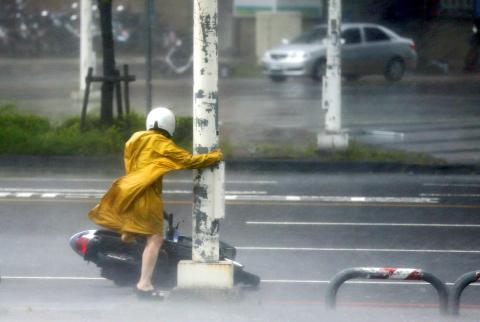
Photo: Ritchie B. Tongo, EPA
By 8:30pm yesterday, the center of Meranti was 70km southwest of Penghu and it had become a weaker typhoon, the Central Weather Bureau said.
The typhoon yesterday morning generated strong winds in Pingtung’s Hengchun Township (恆春), which reached Level 16 on the Beaufort Scale, Central Weather Bureau forecaster Hsieh Ming-chang (謝明昌) said.
This was the strongest since the establishment of an observation station in Hengchun in 1896, he said.
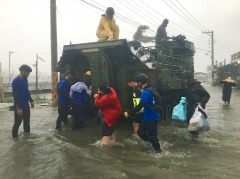
Photo: CNA
Humans are likely to be blown over by a Level 16 gust, the bureau said.
Meranti was forecast to weaken as it moved through the Taiwan Strait, where the sea temperature is low, and the radius of the storm could be shrink further, Hsieh said.
Meranti is forecast to move further toward China via the seas near Kinmen this morning, with Taiwan proper out of the storm’s circumference, he said.
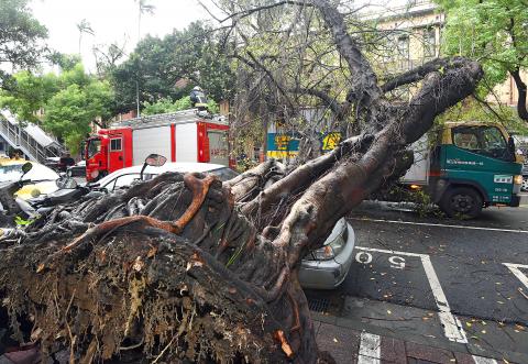
Photo: Liao Chen-huei, Taipei Times
However, some parts of the nation might still see some heavy rainfall this morning due to lingering clouds brought by the typhoon, particularly in the southwest, he said.
The rain and winds would ease by this afternoon, he added.
The typhoon wreaked havoc with many people’s travel plans for the four-day Mid-Autumn Festival holiday, which begins today.
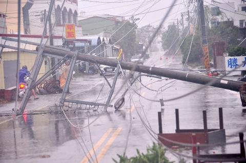
Photo: Tsai Tsung-hsien, Taipei Times
The Taiwan Railways Administration (TRA) on Tuesday canceled services on several rail lines due to the storm and announced yesterday morning that its west coast services would only operate until Chiayi after 6pm.
Southbound services between Hualien and Taitung did not resume until 5:50pm.
Railway tracks and electricity cables along several sections of TRA lines were damaged by the rain and winds generated by the typhoon, including the sections between Dongjhu (東竹) and Fuli (富里) townships in Hualien, Shanli (山里) and Luye (鹿野) townships in Taitung and Kaohsiung and Xinzuoying (新左營).
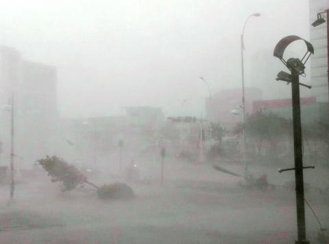
Photo: Ritchie B. Tongo, EPA
Although the Taiwan High Speed Rail Corp (THSR, 台灣高鐵) said on Tuesday night that it would maintain normal operations yesterday, its schedule was interrupted by a pantograph — the frame that carries current to a train — that broke at 1:38pm on the southbound section between Tainan and Zuoying (左營) in Kaohsiung.
The breakage meant that later southbound trains only went as far as Tainan and all northbound trains were dispatched from Tainan rather than Zuoying. THSR used shuttle buses to transport passengers between Tainan and Kaohsiung.
Southbound express train service to Zuoying leaving after 3pm, where trains were not scheduled to stop in Tainan, was also curtailed, with trains only going to Taichung.
The Maritime Port Bureau said 154 shipping services were canceled yesterday, while 233 domestic flights and 175 international flights were canceled, according to the Civil Aeronautics Administration.
At press time last night, schools nationwide suffered storm losses amounting to NT$1.1 million (US$34,712), the Ministry of Education said.
National Feng-shan Senior High School in Kaohsiung’s Fengshan District (鳳山) bore the brunt of the damage, as a parking lot behind an outdoor lecture platform was destroyed, costing the school NT$980,000, the ministry said.
In Kinmen, part of a fence around Hepu Elementary School was damaged by a toppled tree, with repairs estimated to be about NT$50,000, the ministry said.
Meanwhile, another storm, Typhoon Malakas, is moving toward Taiwan.
The bureau could issue a sea alert for Malakas tonight or early tomorrow morning, Hsieh said.
The bureau said Malakas would come closest to Taiwan on Saturday, but its eye is not expected to make landfall. However, it could have a greater impact on Taiwan if its path moves further south, the bureau said.
Malakas is forecast to slow and turn north toward Okinawa and other parts of Japan after it comes close to Taiwan, the bureau added.
Additional reporting by Sean Lin

US President Donald Trump yesterday announced sweeping "reciprocal tariffs" on US trading partners, including a 32 percent tax on goods from Taiwan that is set to take effect on Wednesday. At a Rose Garden event, Trump declared a 10 percent baseline tax on imports from all countries, with the White House saying it would take effect on Saturday. Countries with larger trade surpluses with the US would face higher duties beginning on Wednesday, including Taiwan (32 percent), China (34 percent), Japan (24 percent), South Korea (25 percent), Vietnam (46 percent) and Thailand (36 percent). Canada and Mexico, the two largest US trading

AIR SUPPORT: The Ministry of National Defense thanked the US for the delivery, adding that it was an indicator of the White House’s commitment to the Taiwan Relations Act Deputy Minister of National Defense Po Horng-huei (柏鴻輝) and Representative to the US Alexander Yui on Friday attended a delivery ceremony for the first of Taiwan’s long-awaited 66 F-16C/D Block 70 jets at a Lockheed Martin Corp factory in Greenville, South Carolina. “We are so proud to be the global home of the F-16 and to support Taiwan’s air defense capabilities,” US Representative William Timmons wrote on X, alongside a photograph of Taiwanese and US officials at the event. The F-16C/D Block 70 jets Taiwan ordered have the same capabilities as aircraft that had been upgraded to F-16Vs. The batch of Lockheed Martin

China's military today said it began joint army, navy and rocket force exercises around Taiwan to "serve as a stern warning and powerful deterrent against Taiwanese independence," calling President William Lai (賴清德) a "parasite." The exercises come after Lai called Beijing a "foreign hostile force" last month. More than 10 Chinese military ships approached close to Taiwan's 24 nautical mile (44.4km) contiguous zone this morning and Taiwan sent its own warships to respond, two senior Taiwanese officials said. Taiwan has not yet detected any live fire by the Chinese military so far, one of the officials said. The drills took place after US Secretary

THUGGISH BEHAVIOR: Encouraging people to report independence supporters is another intimidation tactic that threatens cross-strait peace, the state department said China setting up an online system for reporting “Taiwanese independence” advocates is an “irresponsible and reprehensible” act, a US government spokesperson said on Friday. “China’s call for private individuals to report on alleged ‘persecution or suppression’ by supposed ‘Taiwan independence henchmen and accomplices’ is irresponsible and reprehensible,” an unnamed US Department of State spokesperson told the Central News Agency in an e-mail. The move is part of Beijing’s “intimidation campaign” against Taiwan and its supporters, and is “threatening free speech around the world, destabilizing the Indo-Pacific region, and deliberately eroding the cross-strait status quo,” the spokesperson said. The Chinese Communist Party’s “threats