The Central Weather Bureau (CWB) yesterday issued land and sea alerts for Typhoon Dujuan, which has gained strength, adding that residents of mountainous areas in central, northern and northeastern regions should beware the effects of torrential rainfall.
At 10pm last night, today was declared a typhoon day in Taipei, New Taipei City, Taoyuan, Keelung and Yilan County.
At 8pm, Dujuan was centered 500km southeast of Taipei, moving northwest at 14kph. The storm packed gusts of 226.8kph. The bureau reported waves as high as 6m off the coast of Taitung.
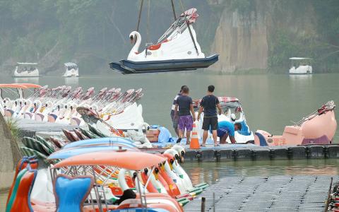
Photo: AFP
Bureau forecaster Lo Ya-yin (羅雅尹) said that the typhoon gained strength when it passed to the south of the Ryukyu Islands, as the sea temperature in the area was favorable for the storm’s further development.
However, she said that the typhoon is forecast to weaken slightly as it approaches Taiwan because of geographical factors and cold air from the north.
When asked about where the typhoon might make landfall, Lo said that typhoons tend to vacillate as they approach coastal areas, adding that landfall could occur as far south as Hualien.
Lo said that the likelihood of precipitation would be high today in the morning and early afternoon in northern and central areas, as well as in Hualien, as the typhoon draws nearer.
However, she said that rain in western, central and northeastern areas would accumulate quickly between late afternoon today and tomorrow morning, as the center of Dujuan is expected to move across Taiwan after landfall.
The bureau estimated that the greatest amount of rainfall would occur in mountainous areas in northern, northeastern and central Taiwan yesterday, today and tomorrow, with rainfall in mountainous areas of New Taipei City potentially reaching 900mm, the most in the nation.
Lo said that the rain is expected to ease tomorrow afternoon or evening, when Dujuan is expected to move across the Taiwan Strait.
According to the bureau, the sea alert applies to ships operating off the nation’s north, northeast and southeast coasts, as well as those in the Bashi Channel and the northern part of the Taiwan Strait.
In preparation for potentially heavy rainfall, the Northern Region Water Resources Office discharged water from reservoirs to avoid overflow when the typhoon arrives.

Intelligence agents have recorded 510,000 instances of “controversial information” being spread online by the Chinese Communist Party (CCP) so far this year, the National Security Bureau (NSB) said in a report yesterday, as it warned of artificial intelligence (AI) being employed to generate destabilizing misinformation. The bureau submitted a written report to the Legislative Yuan in preparation for National Security Bureau Director-General Tsai Ming-yen’s (蔡明彥) appearance before the Foreign Affairs and National Defense Committee today. The CCP has been using cognitive warfare to divide Taiwanese society by commenting on controversial issues such as Taiwan Semiconductor Manufacturing Co’s (TSMC, 台積電) investments in the
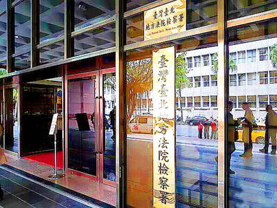
INVESTIGATION: The case is the latest instance of a DPP figure being implicated in an espionage network accused of allegedly leaking information to Chinese intelligence Democratic Progressive Party (DPP) member Ho Jen-chieh (何仁傑) was detained and held incommunicado yesterday on suspicion of spying for China during his tenure as assistant to then-minister of foreign affairs Joseph Wu (吳釗燮). The Taipei District Prosecutors’ Office said Ho was implicated during its investigation into alleged spying activities by former Presidential Office consultant Wu Shang-yu (吳尚雨). Prosecutors said there is reason to believe Ho breached the National Security Act (國家安全法) by leaking classified Ministry of Foreign Affairs information to Chinese intelligence. Following interrogation, prosecutors petitioned the Taipei District Court to detain Ho, citing concerns over potential collusion or tampering of evidence. The

‘COMPREHENSIVE PLAN’: Lin Chia-lung said that the government was ready to talk about a variety of issues, including investment in and purchases from the US The National Stabilization Fund (NSF) yesterday announced that it would step in to staunch stock market losses for the ninth time in the nation’s history. An NSF board meeting, originally scheduled for Monday next week, was moved to yesterday after stocks plummeted in the wake of US President Donald Trump’s announcement of 32 percent tariffs on Taiwan on Wednesday last week. Board members voted to support the stock market with the NT$500 billion (US$15.15 billion) fund, with injections of funds to begin as soon as today. The NSF in 2000 injected NT$120 billion to stabilize stocks, the most ever. The lowest amount it
NEGOTIATIONS: Taiwan has good relations with Washington and the outlook for the negotiations looks promising, Minister of Economic Affairs J.W. Kuo said Taiwan’s GDP growth this year is expected to decrease by 0.43 to 1.61 percentage points due to the effects of US tariffs, National Development Council (NDC) Minister Paul Liu (劉鏡清) said at a meeting of the legislature’s Economics Committee in Taipei yesterday, citing a preliminary estimate by a private research institution. Taiwan’s economy would be significantly affected by the 32 percent “reciprocal” tariffs slapped by the US, which took effect yesterday, Liu said, adding that GDP growth could fall below 3 percent and potentially even dip below 2 percent to 1.53 percent this year. The council has commissioned another institution