The Panamanian government celebrated yesterday after voters backed a US$5.25 billion plan to widen the country's transcontinental canal to allow the world's biggest ships to sail between the Pacific and Atlantic Oceans.
With nearly all the votes counted, election officials announced more than 78 percent of the voters had approved the plan calling for construction of a third set of locks and other modernization work along the waterway.
Only about 22 percent voiced opposition in the course of the referendum, the officials said.
"Today we have become the masters of our own destiny," an elated President Martin Torrijos said in an address to the nation.
"Today, we have laid the foundation of a better country," he said.
Turnout barely reached 40 percent, but officials blamed that in part on a televised soccer match between rivals Barcelona and Real Madrid.
Torrijos and the Canal Authority, the government agency that has run the waterway since it was handed over to Panama by the US in 1999, insisted that not widening the 92-year-old waterway would leave it obsolete after 2012.
About 80 percent of the GDP Panama, which has a population of 3 million, is linked directly or indirectly to canal activity, with the waterway's main users being the US, China and Japan.
Proponents say the canal, through which roughly 4 percent of world trade passes, badly needs an overhaul to accommodate new, larger ships and remain competitive against other maritime routes.
It takes eight to 10 hours to cross the Isthmus of Panama via the 80km canal. But the actual average time, including the wait, is 26 hours.
The proposed third lane, parallel to the existing two, would accommodate massive vessels 366m in length, 49m wide and with a 15m draft.
Construction is scheduled to begin late next year and expected to be completed in 2014.

‘FORM OF PROTEST’: The German Institute Taipei said it was ‘shocked’ to see Nazi symbolism used in connection with political aims as it condemned the incident Sung Chien-liang (宋建樑), who led efforts to recall Democratic Progressive Party (DPP) Legislator Lee Kun-cheng (李坤城), was released on bail of NT$80,000 yesterday amid an outcry over a Nazi armband he wore to questioning the night before. Sung arrived at the New Taipei City District Prosecutors’ Office for questioning in a recall petition forgery case on Tuesday night wearing a red armband bearing a swastika, carrying a copy of Adolf Hitler’s Mein Kampf and giving a Nazi salute. Sung left the building at 1:15am without the armband and apparently covering the book with a coat. This is a serious international scandal and Chinese

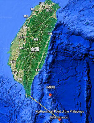
A US Marine Corps regiment equipped with Naval Strike Missiles (NSM) is set to participate in the upcoming Balikatan 25 exercise in the Luzon Strait, marking the system’s first-ever deployment in the Philippines. US and Philippine officials have separately confirmed that the Navy Marine Expeditionary Ship Interdiction System (NMESIS) — the mobile launch platform for the Naval Strike Missile — would take part in the joint exercise. The missiles are being deployed to “a strategic first island chain chokepoint” in the waters between Taiwan proper and the Philippines, US-based Naval News reported. “The Luzon Strait and Bashi Channel represent a critical access

COUNTERINTELLIGENCE TRAINING: The ministry said 87.5 percent of the apprehended Chinese agents were reported by service members they tried to lure into becoming spies Taiwanese organized crime, illegal money lenders, temples and civic groups are complicit in Beijing’s infiltration of the armed forces, the Ministry of National Defense (MND) said in a report yesterday. Retired service members who had been turned to Beijing’s cause mainly relied on those channels to infiltrate the Taiwanese military, according to the report to be submitted to lawmakers ahead of tomorrow’s hearing on Chinese espionage in the military. Chinese intelligence typically used blackmail, Internet-based communications, bribery or debts to loan sharks to leverage active service personnel to do its bidding, it said. China’s main goals are to collect intelligence, and develop a

PERSONAL DATA: The implicated KMT members allegedly compiled their petitions by copying names from party lists without the consent of the people concerned Judicial authorities searched six locations yesterday and questioned six people, including one elderly Chinese Nationalist Party (KMT) member and five KMT Youth League associates, about alleged signature forgery and fraud relating to their recall efforts against two Democratic Progressive Party (DPP) legislators. After launching a probe into alleged signature forgery and related fraud in the KMT’s recall effort, prosecutors received a number of complaints, including about one petition that had 1,748 signatures of voters whose family members said they had already passed away, and also voters who said they did not approve the use of their name, Taipei Deputy Chief Prosecutor