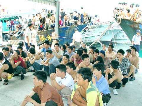
Authorities are preparing for torrential rain and strong winds as Typhoon Conson gains momentum, officials said yesterday.
The typhoon was last night upgraded to a medium-strength typhoon by the Central Weather Bureau.

PHOTO: LEE LI-FA, TAIPEI TIMES
At 10pm last night, the storm's center was 220km south-southwest of Oluanpi, the southernmost tip of Taiwan, the bureau said. The typhoon is predicted to make landfall at 8pm tonight.
Packing gusts of up to 155kph, Conson was moving north-northeast at 11kph.
The bureau warned of heavy downpours in southern areas, urging residents to take precautions against flooding and landslides.
At press time, the typhoon was likely to traverse Taiwan, possibly leaving land in the northwestern counties of Taoyuan or Hsinchu.
The Ministry of National Defense said the military has set up a control center and ordered its personnel to stand by for rescue duties.
The bureau issued a land warning at around noon yesterday. The warning closed down the popular Kenting beaches in southern Pingtung County, which is expected to bear the brunt of the storm, while fishing boats have sought shelter at ports.
Meanwhile, water management officials yesterday expressed anger at the theft of at least 68 sluice gates across the country, saying the thefts could wreak unnecessary damage upon areas already threatened by the typhoon.
Yesterday, while making preparations for the storm, an astonished Water Conservancy Department discovered that 68 smaller sluice gates were missing.
"We have reinstalled 42 of them so far, but reinstallation of 26 gates in Taichung and Chiayi counties is not yet complete," an official said.

INVESTIGATION: The case is the latest instance of a DPP figure being implicated in an espionage network accused of allegedly leaking information to Chinese intelligence Democratic Progressive Party (DPP) member Ho Jen-chieh (何仁傑) was detained and held incommunicado yesterday on suspicion of spying for China during his tenure as assistant to then-minister of foreign affairs Joseph Wu (吳釗燮). The Taipei District Prosecutors’ Office said Ho was implicated during its investigation into alleged spying activities by former Presidential Office consultant Wu Shang-yu (吳尚雨). Prosecutors said there is reason to believe Ho breached the National Security Act (國家安全法) by leaking classified Ministry of Foreign Affairs information to Chinese intelligence. Following interrogation, prosecutors petitioned the Taipei District Court to detain Ho, citing concerns over potential collusion or tampering of evidence. The

NEGOTIATIONS: Taiwan has good relations with Washington and the outlook for the negotiations looks promising, Minister of Economic Affairs J.W. Kuo said Taiwan’s GDP growth this year is expected to decrease by 0.43 to 1.61 percentage points due to the effects of US tariffs, National Development Council (NDC) Minister Paul Liu (劉鏡清) said at a meeting of the legislature’s Economics Committee in Taipei yesterday, citing a preliminary estimate by a private research institution. Taiwan’s economy would be significantly affected by the 32 percent “reciprocal” tariffs slapped by the US, which took effect yesterday, Liu said, adding that GDP growth could fall below 3 percent and potentially even dip below 2 percent to 1.53 percent this year. The council has commissioned another institution

NEGOTIATIONS: The US response to the countermeasures and plans Taiwan presented has been positive, including boosting procurement and investment, the president said Taiwan is included in the first group for trade negotiations with the US, President William Lai (賴清德) said yesterday, as he seeks to shield Taiwanese exporters from a 32 percent tariff. In Washington, US Trade Representative Jamieson Greer said in an interview on Fox News on Thursday that he would speak to his Taiwanese and Israeli counterparts yesterday about tariffs after holding a long discussion with the Vietnamese earlier. US President Donald Trump on Wednesday postponed punishing levies on multiple trade partners, including Taiwan, for three months after trillions of US dollars were wiped off global markets. He has maintained a 10 percent

TRADE: The premier pledged safeguards on ‘Made in Taiwan’ labeling, anti-dumping measures and stricter export controls to strengthen its position in trade talks Products labeled “made in Taiwan” must be genuinely made in Taiwan, Premier Cho Jung-tai (卓榮泰) said yesterday, vowing to enforce strict safeguards against “origin laundering” and initiate anti-dumping investigations to prevent China dumping its products in Taiwan. Cho made the remarks in a discussion session with representatives from industries in Kaohsiung. In response to the US government’s recent announcement of “reciprocal” tariffs on its trading partners, President William Lai (賴清德) and Cho last week began a series of consultations with industry leaders nationwide to gather feedback and address concerns. Taiwanese and US officials held a videoconference on Friday evening to discuss the