The summer sun has your head and chest trapped in a sauna-like heat locker. There is no breeze. You’re panting like a dog. You may be hungover. Did we mention that you’re bicycling up a 7 percent gradient?
The worst is over on this morning workout. The climb tops off after half an hour at the Pingdengli (平等里) ledge some 475m above sea level. A breeze cuts the sun as clouds gather on the ridges above. A canyon below opens out onto views of the Taipei basin. There’s water, even country-style food.
The accordion-shaped Pingjing Street (平菁街) climb from Zhishan Road (至善路) just above the National Palace Museum (國立故宮博物院) cures hangovers while penetrating deep into the less trafficked backside of Yangmingshan National Park (陽明山國家公園).
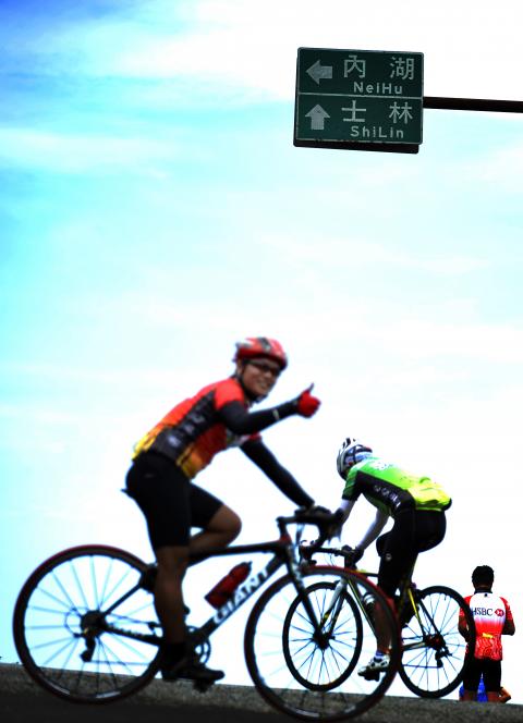
Photo Courtesy of Chris Stowers
It’s just one in a maze of well paved, vista-packed and challenging roads in the park, the boundary of which is 30 to 60 minutes cycling time from central Taipei.
Among the highlights: Datunshan(大屯山) at 1,077m above sea level, about the highest road elevation in greater Taipei, views of the Pacific Ocean from a lookout above Lengshuikeng (冷水坑) and a chain of coffeehouses hidden in the forest.
“It’s the best cycling spot in northern Taiwan,” says regular rider Lan Yang-po, (藍陽波) 40, who works in Taipei. “The mountains are higher. The ride times are longer. The roads go just about everywhere, but there’s not a lot of traffic. And after riding flat streets too long, you get bored and need challenges.”
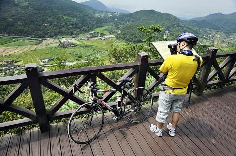
Photo Courtesy of Chris Stowers
Trails in the park are off limits to bikes, but all the public roads are open. A range of bike gears and ample water supplies are not just suggestions.
Here are three of Yangmingshan’s top rides:
PINGDENGLI TO LENGSHUIKENG
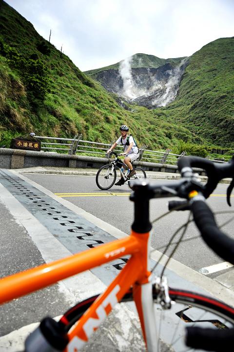
Photo Courtesy of Chris Stowers
From the National Palace Museum, four-lane Zhishan Road follows the raging Shuangxi (雙溪) creek to the road’s only signaled left turn. From there a curvaceous set of zigzags rises sharply up a ridge between two canyons, hence the heat locker, the panting and the cure for hangovers. About 30 minutes puts you into Pingdengli.
Follow the main road over the Pingdengli ledge past country-style restaurants, a vista point and a roadside market. Pedal under the shadow of several giant telecom satellite dishes. Turn right at the bilingual marker for Chingshan (菁山).
Another 30 minutes of low-gear climbing, this time at cooler elevations of 500m to 800m, lead through mid-elevation forests to Lengshuikeng (冷水坑), a stopover for bottled water, free hot spring baths and trailhead access to the park’s highest peak.
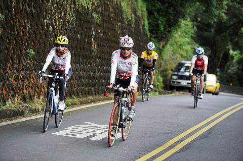
Photo Courtesy of Chris Stowers
A final steep grade, left, lifts riders to views of Jinshan (金山) and the ocean on the left. The next T-intersection means descending into Jinshan, right, or circling back to the left over Xiaoyoukeng (小油坑) and down Yangde Boulevard (仰德大道), a hill back to central Taipei that’s straight enough in some parts for bikes to rival the speed of cars. This ride takes two to three hours.
TIENMU TO DATUNSHAN
A narrow two-lane road climbs from behind the Tienmu Baseball Stadium (天母棒球場), located at 77, Zhongcheng Rd Sec 2, Taipei City (台北市忠誠路二段77號), past a cluster of restaurants-with-a-view to the Chinese Cultural University lookout decks. This route, Dongshan Road (東山路) Lane 25, gets steep enough to bring veteran riders crying to their grannies (as in granny gear).
Cut around the campus to Yangde Boulevard (仰德大道) and follow its switchbacks north past the Yangmingshan Visitors Center (陽明山國家公園遊客中心) to a bridge over the creek created by the Xiaoyoukeng geyser. That spewing white geyser framed by forest and grassland looms high on the right. Views of the Zhuzihu (竹子湖) valley are on the left.
This segment is a steady but not steep climb. Competition from cars and buses, however, increases on weekends.
A left turn just past the bridge and around 750m above sea level is Balaka Road (巴拉卡路). Its mild ascent peaks at Erziping (二子坪), a spot at which to refuel on liquids.
From the Erziping parking lot, a spur road sometimes off limits to cars finishes the ascent to Datunshan at 1,077m above sea level. The final climb is not for wimps. But the view may be, as Datun often loses itself in cloud cover or fog.
Back at Erziping, plummet down Balaka Road over 10km that go by so fast riders can feel the air temperature shoot back from spring-like to sultry. From the Beixinzhuang (北新庄) split, go left another 5km to Tamsui (淡水). The MRT takes bikes on weekends at the nearby Hongshulin MRT Station (紅樹林捷運站) on the Red Line.
NATIONAL PALACE MUSEUM TO FENGGUIZUI
When bikes became a citywide rage in 2008 as fuel prices went up and the economy down, Taipei’s more advanced riders glommed onto this route for its light traffic and access to a part of Yangmingshan that’s hard to reach by foot or bus.
It remains a popular proving ground today, with riders in full cycling armor charging up the 10km-long stretch of road on weekend mornings and then hurtling back down at warp speed.
Take Zhishan Road a kilometer or two past the Pingdengli turnoff (see ride above) to Wanxi Road (萬溪路). Go right and drop a gear or three through dense jungle to a T-intersection. Turn left into the national park and more dense forest, which gives way to views of the Taipei basin above about 500m.
A cartoony sign that reads “the summit is just ahead,” one in a coordinated series of postings to encourage bikes, heralds a three-way intersection at around 600m above sea level. This is the Fengguizui (風櫃嘴) pass.
A foot trail heads into the park. An outdoor coffee shop is on the other side. A few riders proceed straight to Wanli Township (萬里鄉) on the north coast. Some take a right toward Neihu (內湖) on a route with left-side views ranging from the coast to Taipei 101, while others just turn around and bomb back down to the starting point.

That US assistance was a model for Taiwan’s spectacular development success was early recognized by policymakers and analysts. In a report to the US Congress for the fiscal year 1962, former President John F. Kennedy noted Taiwan’s “rapid economic growth,” was “producing a substantial net gain in living.” Kennedy had a stake in Taiwan’s achievements and the US’ official development assistance (ODA) in general: In September 1961, his entreaty to make the 1960s a “decade of development,” and an accompanying proposal for dedicated legislation to this end, had been formalized by congressional passage of the Foreign Assistance Act. Two

Despite the intense sunshine, we were hardly breaking a sweat as we cruised along the flat, dedicated bike lane, well protected from the heat by a canopy of trees. The electric assist on the bikes likely made a difference, too. Far removed from the bustle and noise of the Taichung traffic, we admired the serene rural scenery, making our way over rivers, alongside rice paddies and through pear orchards. Our route for the day covered two bike paths that connect in Fengyuan District (豐原) and are best done together. The Hou-Feng Bike Path (后豐鐵馬道) runs southward from Houli District (后里) while the
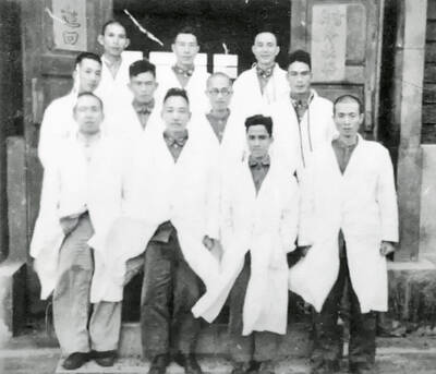
March 31 to April 6 On May 13, 1950, National Taiwan University Hospital otolaryngologist Su You-peng (蘇友鵬) was summoned to the director’s office. He thought someone had complained about him practicing the violin at night, but when he entered the room, he knew something was terribly wrong. He saw several burly men who appeared to be government secret agents, and three other resident doctors: internist Hsu Chiang (許強), dermatologist Hu Pao-chen (胡寶珍) and ophthalmologist Hu Hsin-lin (胡鑫麟). They were handcuffed, herded onto two jeeps and taken to the Secrecy Bureau (保密局) for questioning. Su was still in his doctor’s robes at

Mirror mirror on the wall, what’s the fairest Disney live-action remake of them all? Wait, mirror. Hold on a second. Maybe choosing from the likes of Alice in Wonderland (2010), Mulan (2020) and The Lion King (2019) isn’t such a good idea. Mirror, on second thought, what’s on Netflix? Even the most devoted fans would have to acknowledge that these have not been the most illustrious illustrations of Disney magic. At their best (Pete’s Dragon? Cinderella?) they breathe life into old classics that could use a little updating. At their worst, well, blue Will Smith. Given the rapacious rate of remakes in modern